Thursday, January 9th, 2020
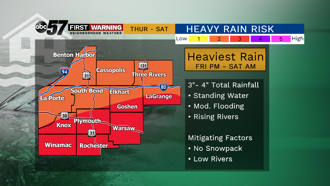
Temperatures rise into the 40s for Thursday and Friday, along with rain showers moving into the region. The rain starts Thursday evening and lasts through Friday and into Saturday morning. The heaviest rain is expected Friday night into Saturday morning. 3-4" of rain are possible with locally higher amounts possible. This brings concern for flooding in low lying areas and rivers are expected to swell. On Saturday the rain changes over to a wintry mix and snow. There could be a period of freezing rain but that line between freezing rain, sleet and snow will unfold as the system is moving through. Right now, not much snow is expected from this system.
Today: Mostly cloudy, breezy, PM rain. High of 48.
Tonight: Rainy. Low of 46.
Friday: Scattered rain showers. High of 52.
Saturday: Rainy, temperatures fall from 38, rain changing to snow late.