
-
1:17

Cold and soaking rain today, another severe risk tomorrow
-
0:44

South Bend High School Music Festival highlights student talent
-
1:55

South Bend house fire possibly caused by lightning
-
2:26

Flooding remains a threat into Wednesday
-
0:40

Baxmeyer defends actions amid solar farm bond debate
-
2:11

Southwest Michigan Cares Fund reaches over $70k as families still...
-
1:35

Severe weather threat ending across Michiana
-
0:51

SJCPD responds to AG’s appeal of lawsuit dismissal
-
2:13

More strong storms likely this evening
-
2:15

The ingredients for severe weather
-
2:14

Why summer travel prices may spike due to the ongoing war in...
-
1:49

Heavy rain, high winds, and hail are main severe concerns today

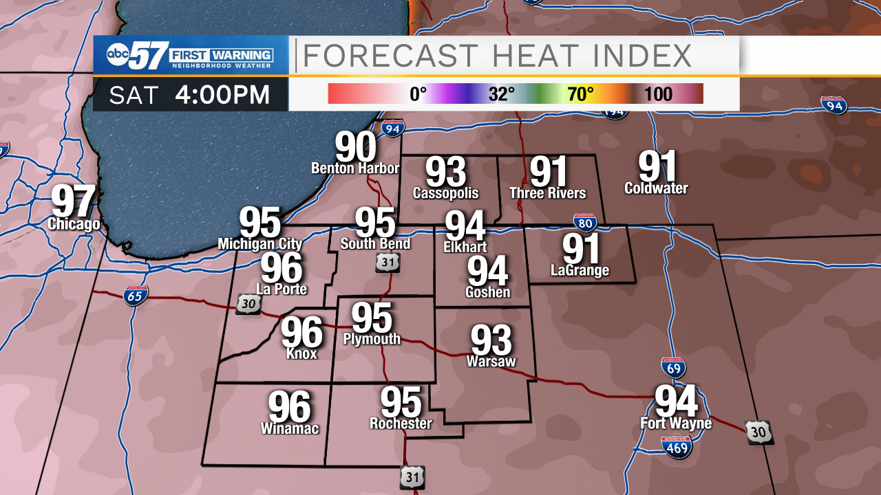
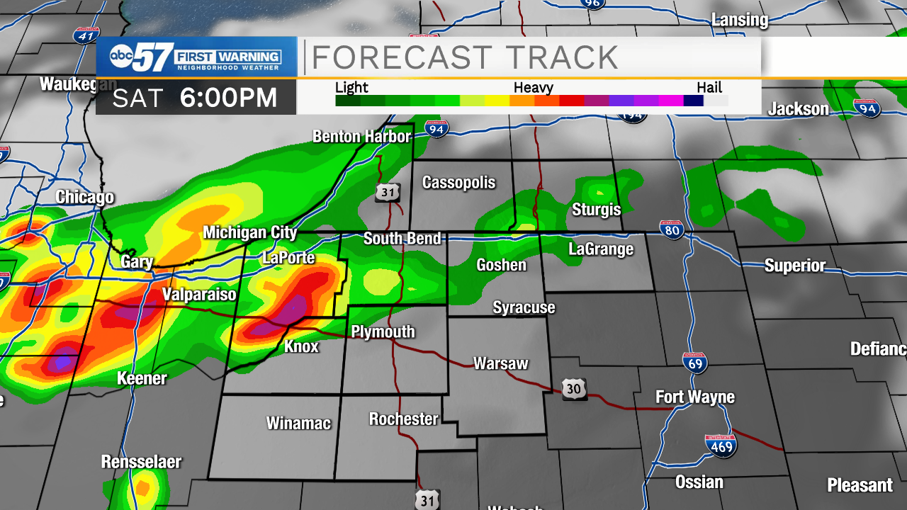
Smoke, haze and high humidity Saturday, air quality will be at worst through Saturday evening, until a front changes the wind direction. There is also the chance of showers and thunderstorms Saturday evening, a few storms could be strong to severe. There's still some uncertainty in how wide the coverage of storms will be, the greatest threat is wind gusts more than 50 mph. The smoke clears Sunday but the heat stays, highs flirt with 90 through the middle of next week.
Tonight: Partly cloudy. Low 72.
Saturday: PM thunderstorms. High 88.
Sunday: Mostly sunny. High 88.
Monday: Sunny. High 88.
Sign up for the ABC 57 Newsletter