Hot temperatures and muggy conditions stick around through tomorrow


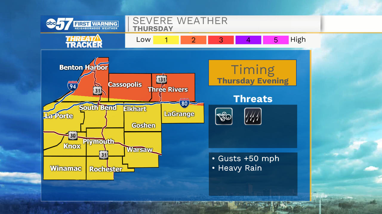
This morning we are tracking dry weather for the rest of the day. This afternoon will be hot and humid with high temperatures topping out in the low to mid 90s. Heat index values will top out in the upper 90s, so make sure to be extremely cautious while working outside this afternoon. The heat and humidity will stick around for tomorrow afternoon as well with highs topping out in lower 90s. Low rain and storm chances are in the forecast for tomorrow evening. The ingredients will be available to produce a few strong storms tomorrow evening, but right now most of the storm activity will stay to our north.
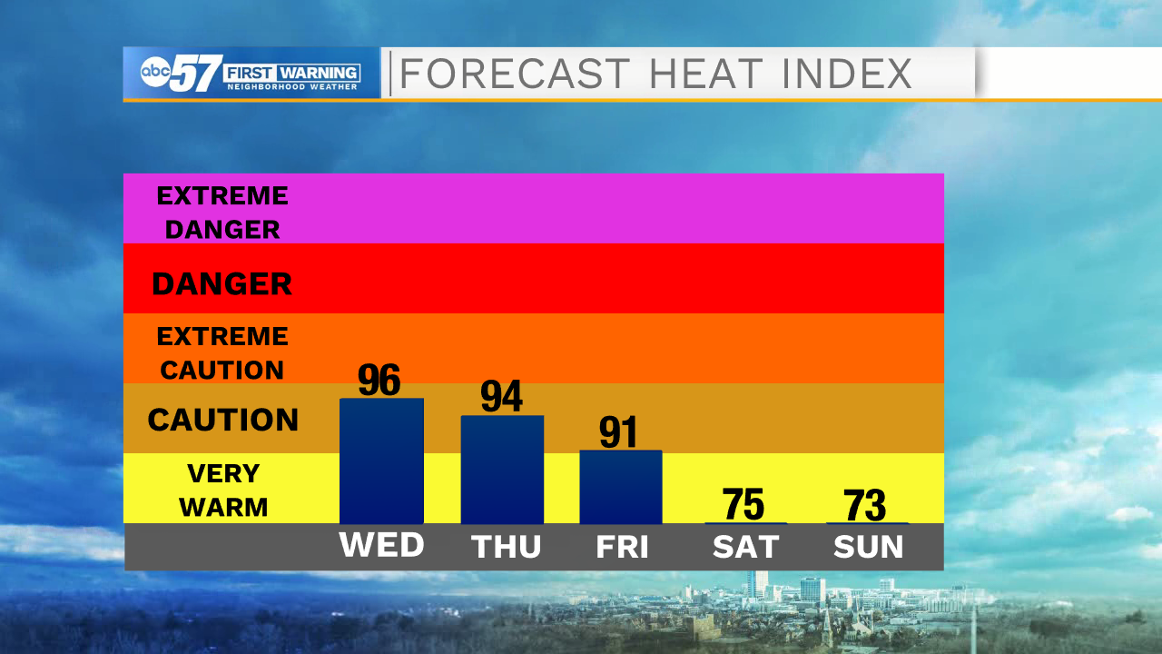
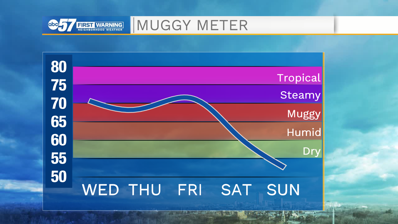
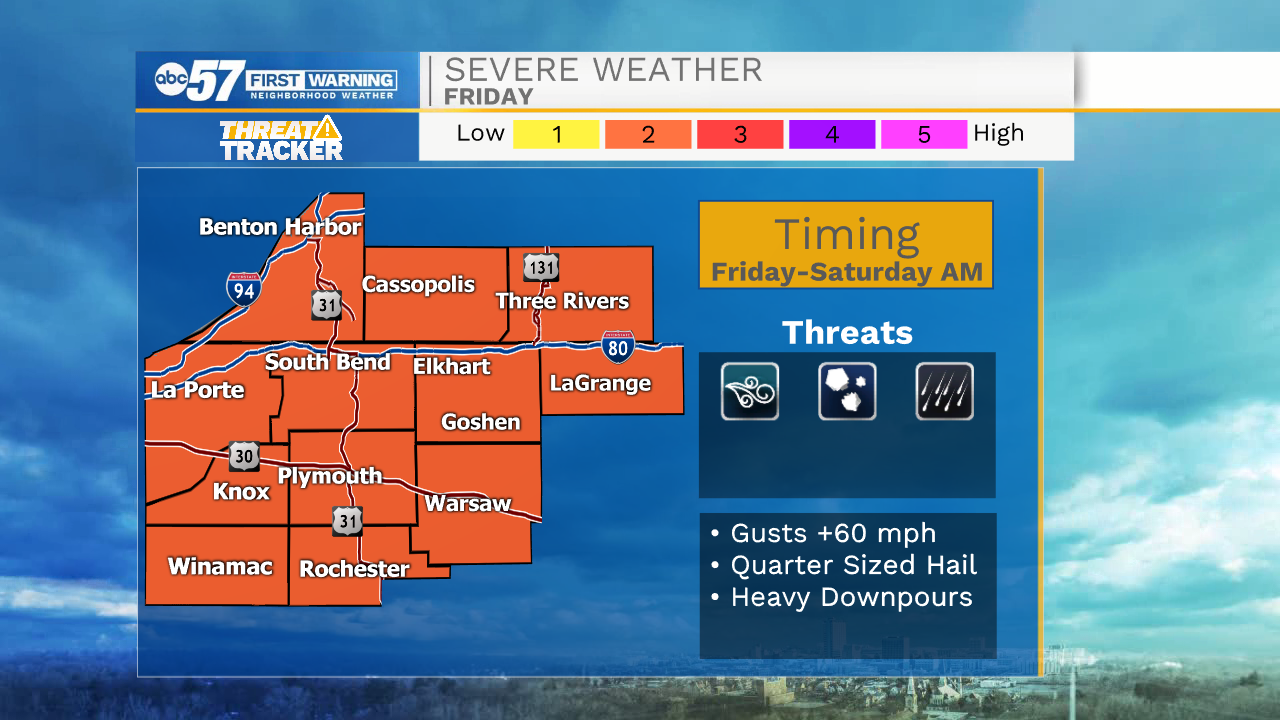
Friday looks to be our next best chance for rain showers and a few strong to severe storms. Isolated rain showers will stick around throughout the day Friday, but then widespread showers and storms are expected Friday night into Saturday morning. A big cool down is on the way for Saturday and Sunday with highs topping out in the upper 70s. Early next week more rain and storm chances are on the way with highs topping out in the upper 70s to lower 80s.
Today: Sunny and hot. High 93.
Tomorrow: Mostly sunny. High 92.
Friday: Scattered showers and storms. High 88.
Saturday: Mostly sunny. High 78.