-
0:49

Celebrating St. Patrick’s Day at Corby’s Irish Pub
-
1:58

The Free Market promotes sustainable shopping
-
3:27

Federal judge temporarily blocks RFK Jr.’s vaccine policy changes...
-
1:02

Chicory Cafe celebrates St. Patrick’s Day with corned beef...
-
2:43

City of Elkhart, EPA, IDEM prepare for removal of contaminated...
-
2:58

South Bend goes green for St. Paddy’s Day at Fiddler’s Hearth
-
2:32

St. Joseph County boards, City of Mishawaka, approve Memorandum...
-
2:40

More than just fighting fires: Warsaw fire official helps with...
-
1:38

Snow Wednesday, rain Thursday, mild Friday
-
2:11

Snow wrapping up today, returns tomorrow
-
4:39

The Morris debuts its 2026-27 season lineup
-
2:25

Lake effect snow through this morning

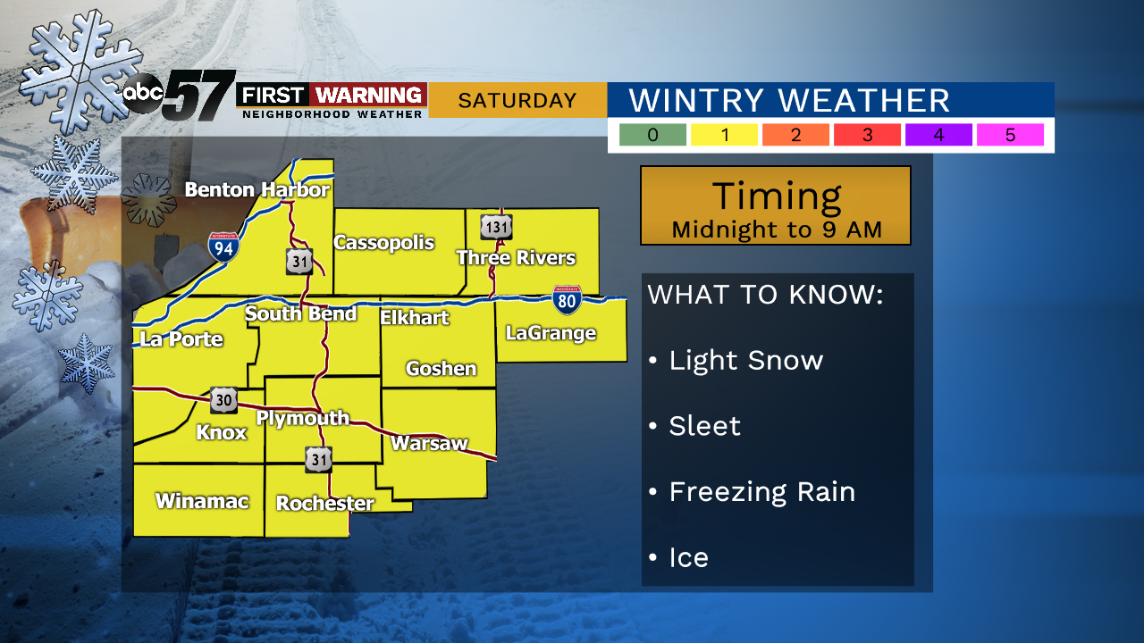
More typical, lasting, January cold is likely as the pattern flips to end the week. Wednesday is still mild with a slight chance of rain / drizzle. Temperatures fall through Thursday, breezy with gusts topping 30 mph. Friday is cold and dry during the day. Friday evening snow is likely, changing to sleet, then freezing rain early Saturday morning. The greatest concern for slick / icy roads is before 9 AM Saturday. Temperatures warm above freezing Saturday, ice melts and precipitation is all rain. Temperatures fall again Saturday night with a chance of light snow off the lake.
Tonight: Partial clearing. Low of 30.
Wednesday: Mostly cloudy, chance of drizzle. High of 42.
Thursday: Partly cloudy, breezy, colder. Temperature fall from 30.
Friday: Mostly cloudy, snow late. High of 30.
Saturday: Freezing rain early, then all rain. High of 40.