
-
0:09

Crews repair weekend washout under Coloma train track
-
0:58

Chilly and sunny Tuesday ahead
-
0:41

Elkhart police investigating Monday night shooting
-
3:47

Elkhart Police Department accepting applications to Citizens...
-
0:52

A slight warm-up but chilly weather still dominates
-
1:09

Bitterly cold out the door
-
3:03

Looking to younger generations to keep Dyngus Day thriving
-
3:06

Even as rivers recede, Marshall County still dealing with flooding
-
3:29

Michigan fans gather in Indianapolis ahead of National Championship...
-
3:22

Hamlet local and tow truck driver describes US 30 crash site...
-
4:28

Dyngus Day celebrations highlight voter turnout, transparency
-
4:54

Now-disbanded St. Joseph County Metro Homicide Unit investigator...

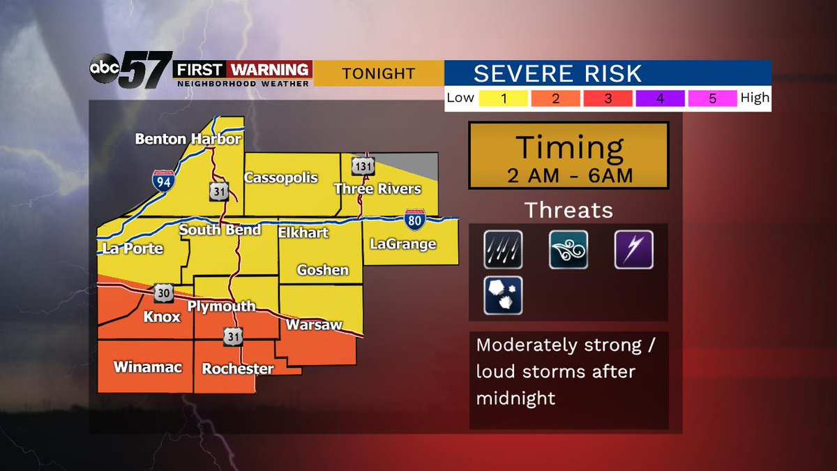
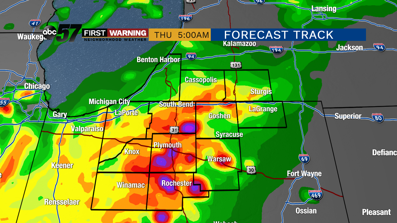
Another round of showers/storms overnight into early Thursday. These storms could be a little loud with heavy rain and gusty wind. Widespread damage is not expected but these storm could be stronger than typical morning storms.
Clouds clear Thursday, another fair afternoon with highs in the mid to upper 70s. Temperatures stay mild through the weekend, highs in the 70s and a chance of scattered showers or storms. No day in particular is a washout but have a plan to dodge showers or a thunderstorm. The pattern of scattered showers and storm continues through the end of next week. Rain total will vary but a range of one to three inches is possible over the next 10 days.
Tonight: Overnight rain/thunderstorms, low of 64.
Thursday: Morning showers, then clearing, high of 76.
Friday: Partly cloudy, chance of showers, high of 78.