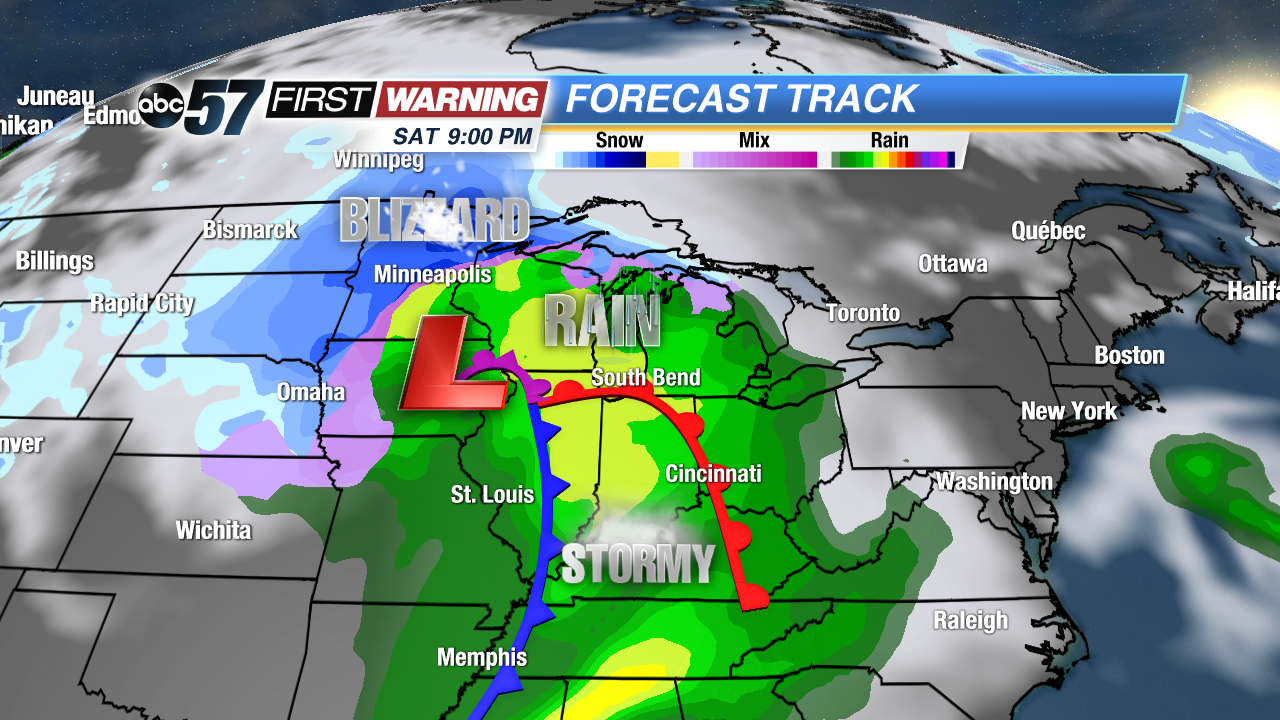
 Major storm system to impact the region this weekend. Storm's position Saturday evening.
Another weekend, another major storm impacting the eastern half of the United States. This one will be eerily similar to the one that "bombed out" back on February 24th and caused intense wind gusts for nearly 24 straight hours across the Great Lakes. It's probably difficult to forget constant wind gusts of 40-65 mph! This system will develop near the Oklahoma-Texas border before rapidly strengthening as it heads northeastward into Kansas, Iowa and Wisconsin.
 The most substantial impacts will be felt all day Saturday and most of Sunday.
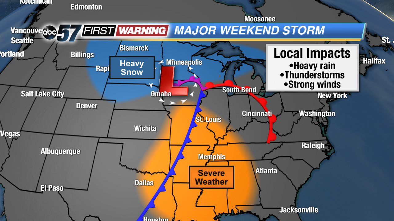
As the low pressure takes this path, it will pack quite the punch. Multiple weather extremes will occur, ranging from a substantial severe weather threat to blizzard conditions. As it stands Tuesday evening, the severe threat will be to our south. States with the highest chance of seeing damaging winds and tornadoes include parts of Oklahoma, Texas, Louisiana, Mississippi, Alabama, Arkansas, Missouri, and Tennessee. It's too early to say whether or not this event will be as extreme as the severe weather outbreak that struck the Deep South this past Sunday. Of course, that outbreak produced a tornado that killed 23 people in Lee County, Alabama.
The wintry and even blizzard-like conditions will greatly stay to our west and northwest across the Northern Plains and Upper Midwest. Several inches of snow and very strong winds are likely in parts of Montana, the Dakotas, Nebraska, Minnesota, and Wisconsin. But what about between those two extremes?
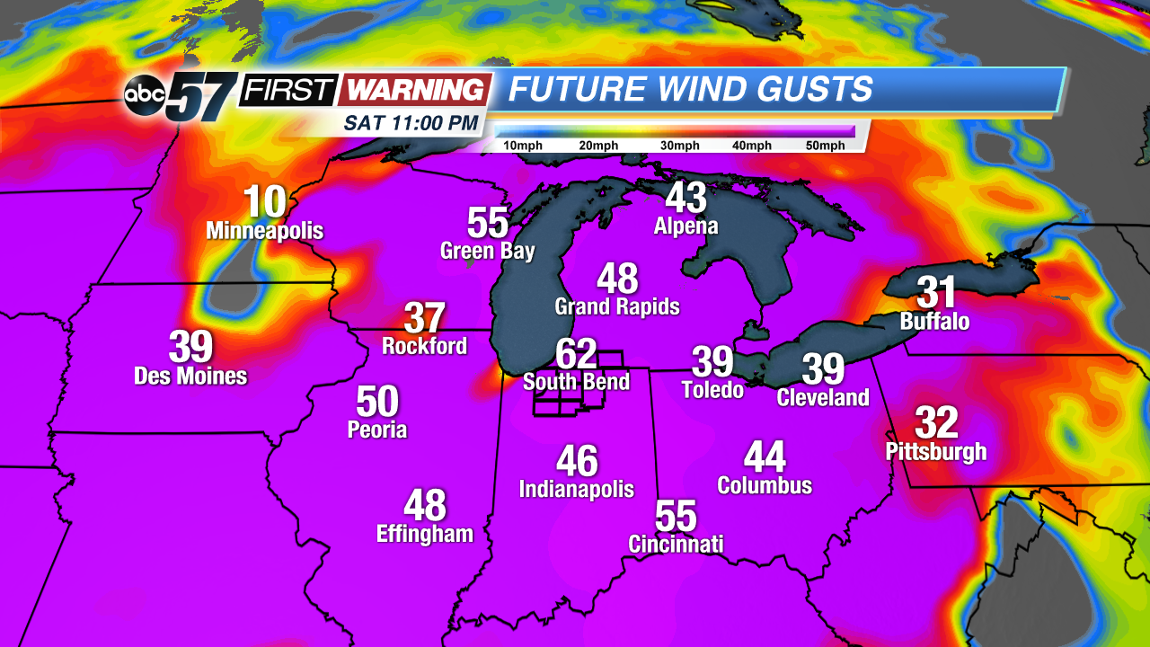
 Potential wind gusts Saturday into Sunday.
Most of Illinois, Indiana, Ohio, Kentucky, and Michigan will dodge the substantial severe weather and winter weather. That's the good news for Michiana and surrounding areas. The risks we
do have as this potent system rolls through are:
•Rain, perhaps heavy at times
•A few thunderstorms
•Strong to damaging wind gusts
The latter is the most concerning because of the risks associated with strong wind gusts. By Saturday evening, wind gusts are expected to reach 40-55 mph. They will continue to be that strong at times through the end of the day Sunday. One tidbit to keep in mind regarding the expected strong winds is the fact that any showers or storms that push through Saturday evening/night could bring with them the chance of a few enhanced wind gusts of 55+ mph. Stick with ABC 57 News for additional details as this system develops later this week.

