


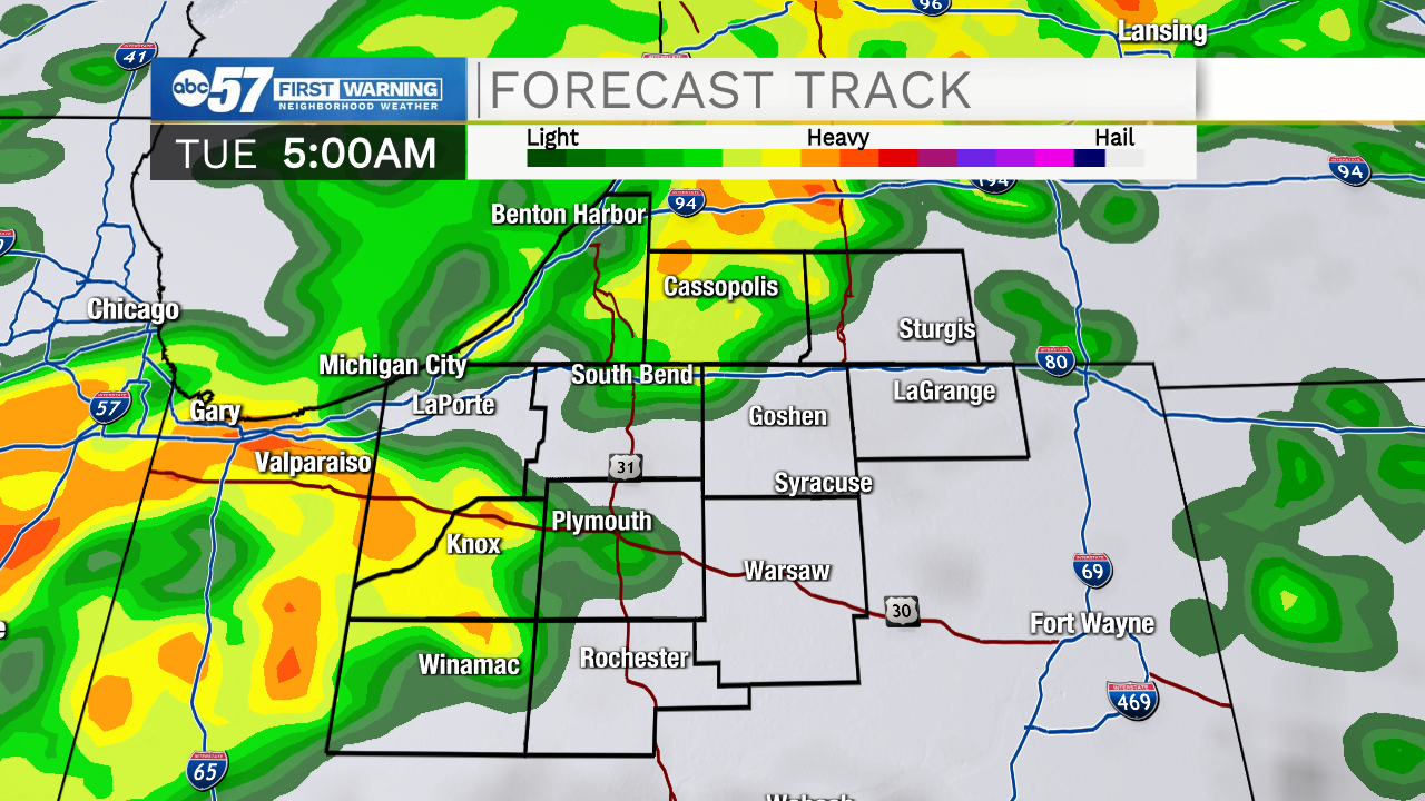
Another round of showers and storms Monday night into early Tuesday as the next front slides through. The severe threat is VERY low.
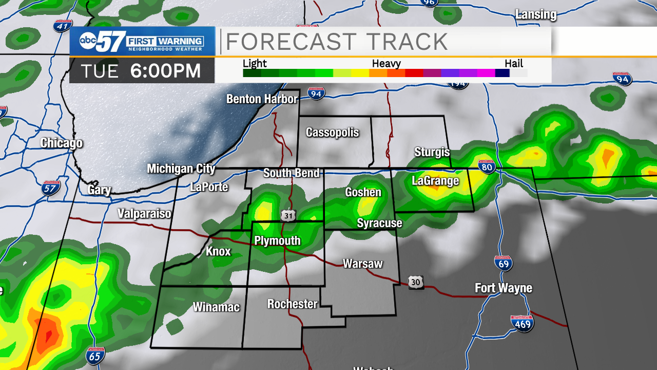
Typical fall turbulence, where uncertainty is the constant. Tuesday will be a little bit of everything, from rain in the morning, breaks of sun and mild temperatures through midday and a quick warm-up with pop-up afternoon storms. There will be a sharp divide in temperature as a front divides the area. Wednesday we warm-up and we cool again quickly Thursday and Friday. The swings continue this weekend with another warm-up and chance of storms Saturday and milder temps Sunday.
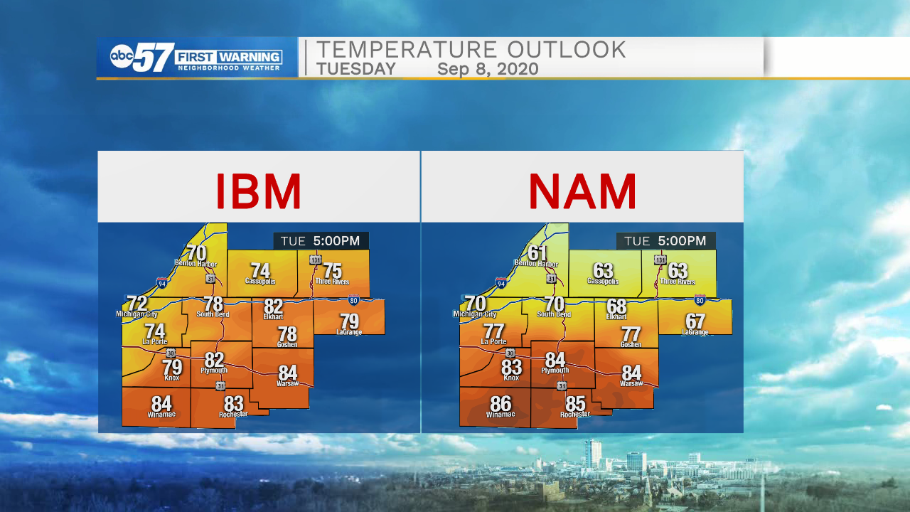
Where will the temperature divide be Tuesday afternoon? Models pinpoint somewhere between South Bend and Plymouth.
Tonight: Scattered showers and thunderstorms. Low 62.
Tuesday: Scattered showers and thunderstorms. High 76.
Wednesday: Partly cloudy. High 80.
Thursday: Partly cloudy. High 70