
-
3:07

Mother raises concerns after son hospitalized in salmonella outbreak...
-
0:38

New YMCA daycare construction begins in South Bend
-
4:02

The impact of President Trump’s endorsements in Indiana primaries
-
2:33

South Bend Chocolate Company files lawsuit against South Bend...
-
26:00

South Bend Chocolate Company gives press conference on airport...
-
0:52

Cool through the rest of week
-
0:51

Cooler out the door than yesterday
-
2:15

South Bend Cubs snap five-game losing streak with 9-1 win over...
-
1:40

Joe Morris wins Marshall County prosecutor primary race
-
2:37

Pressel declared victor by wide margin in primary race for Indiana...
-
1:53

YOUR VOICE, YOUR VOTE: Tracking Elkhart County sheriff primary...
-
1:56

McFarland wins Marshall County sheriff primary race

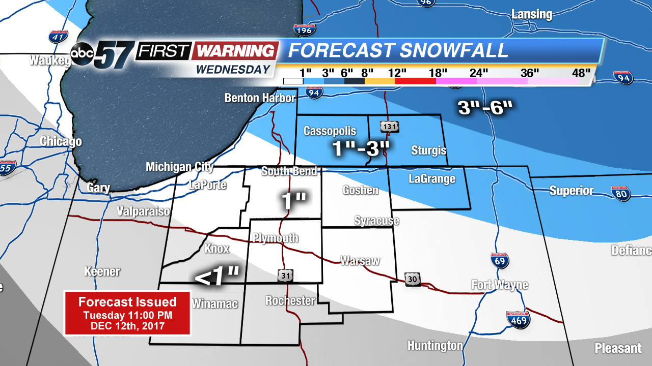 Updated snowfall forecast for Wednesday
Lake effect snow showers will come to an end this evening. Treated roads may turn icy and slick and low drop into the teens tonight.
More system snow Wednesday, this will bring a quick one to three inches for most of Michiana. The pattern stays snowy and cold through the end of the week. The pattern finally breaks this weekend with temperatures warming above freezing. There is a chance of wintry mix Sunday before skies clear and temperatures continue to warm next week.
Tonight: Lake effect snow ending, low 15.
Wednesday: Scattered snow showers, high of 28.
Thursday: Scattered snow showers, high or 24.
Friday: Scattered snow showers, highs near 30.
Sign up for the ABC 57 Newsletter