
-
0:09

Crews repair weekend washout under Coloma train track
-
0:58

Chilly and sunny Tuesday ahead
-
0:41

Elkhart police investigating Monday night shooting
-
3:47

Elkhart Police Department accepting applications to Citizens...
-
0:52

A slight warm-up but chilly weather still dominates
-
1:09

Bitterly cold out the door
-
3:03

Looking to younger generations to keep Dyngus Day thriving
-
3:06

Even as rivers recede, Marshall County still dealing with flooding
-
3:29

Michigan fans gather in Indianapolis ahead of National Championship...
-
3:22

Hamlet local and tow truck driver describes US 30 crash site...
-
4:28

Dyngus Day celebrations highlight voter turnout, transparency
-
4:54

Now-disbanded St. Joseph County Metro Homicide Unit investigator...

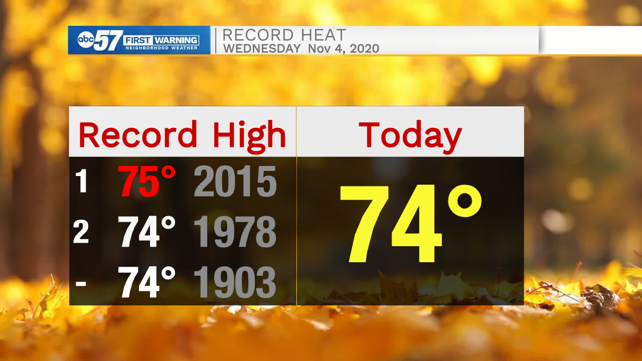
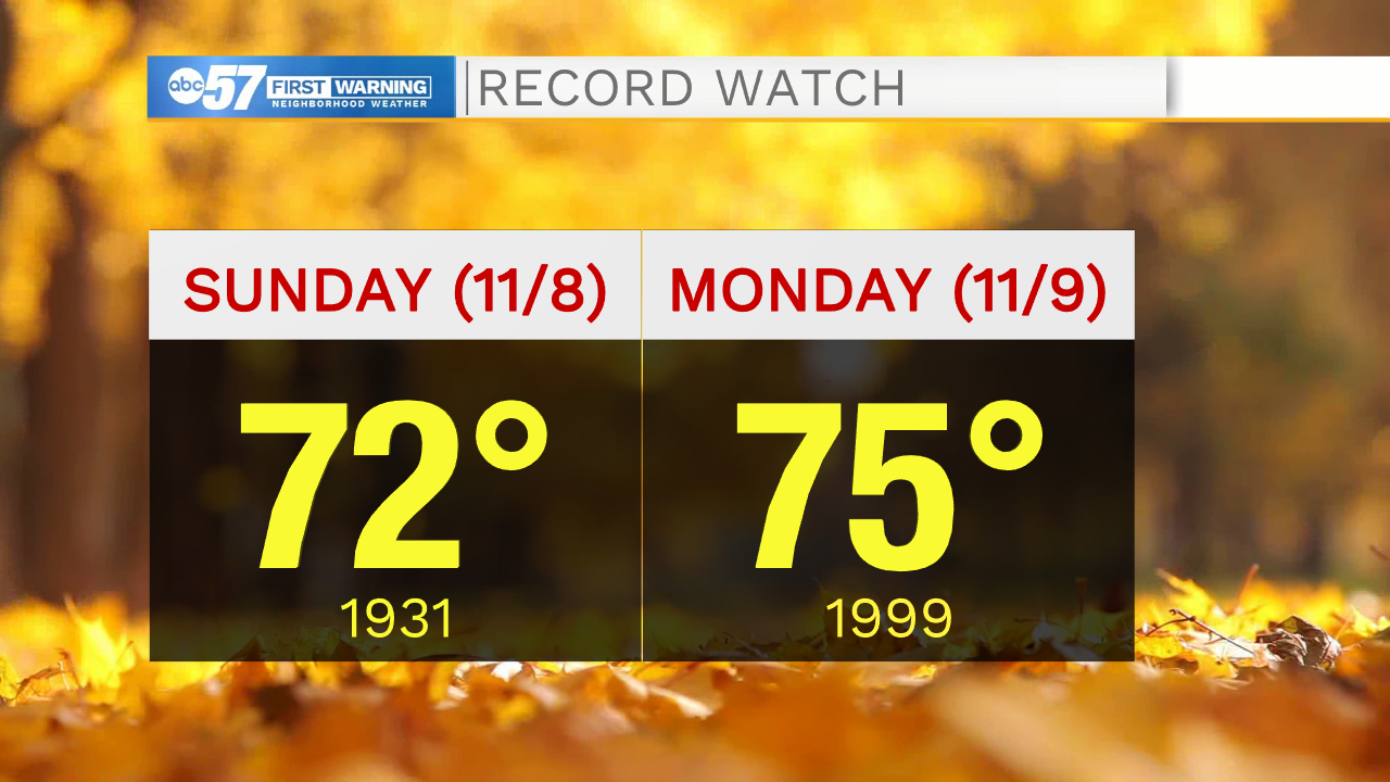
We are in the middle of one of, if not the warmest start to November on record. Highs will be at or above 70 through Monday with the possibility of record highs Sunday and Monday. The one exception is Thursday, as clouds may limit the warm-up to the upper 60s. Temperatures rise steadily each day starting Friday, peaking Monday. The warmth now looks to last into Tuesday before temperatures drop into Wednesday.
Tonight: Partly to mostly cloudy. Low 54.
Thursday: Partly cloudy. High 68.
Friday: Sunny. High 70.
Saturday: Sunny. High 72.
Sign up for the ABC 57 Newsletter