Prolonged cold plunge possible


 Warm and mild for most of October, but temps flip this week.
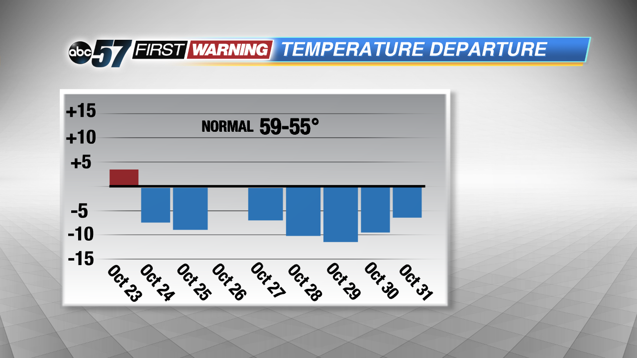
Even though the rain is starting up today, highs today will the warmest we see for quite some time. A couple cold fronts, enhancing the showers from today through Wednesday, will pull temperatures down into the lower 50s by the middle of the week. Recovery doesn't last long as a third front is scheduled to bring more rain showers and another cold dive for the weekend. This is where we could see some changes.
Morning lows for the weekend could bottom out around freezing, with some even falling below that mark. This could mean that we see one of our first widespread frost, or even freeze, events over the weekend. Below average temperatures are also expected to stay put in Michiana through Halloween and into early November, according to the Climate Prediction Center.
Mornings next week could continue to be frosty and lake effect snow showers can't even be ruled out, most likely falling up north in Berrien and Cass counties. No accumulations are expected with any snowfall as surface temperatures would still be holding in the 40s.
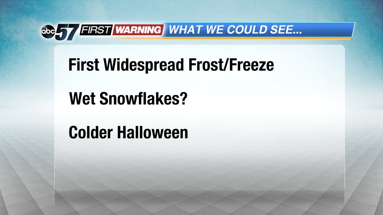 With colder temps expected into early November, some winter weather can't be completely ruled out.