


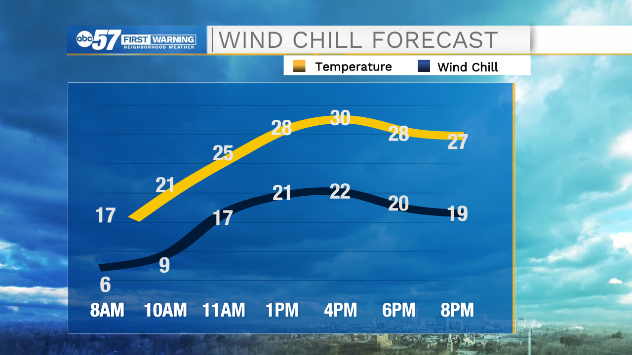
The weekend is starting with a quiet but cool Saturday. Wind chill temperatures this morning are in the single digits, so remember not to spend too long outdoors in the cold. Temperatures warm to 30 degrees this afternoon, but with wind chill, will only feel like the low 20s. Skies are a mix of clouds and sunshine today.
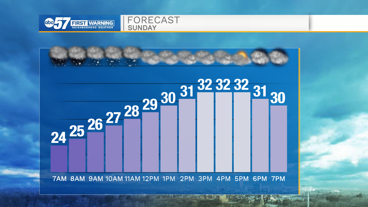
Overnight there are a few scattered snow showers or snow flurries. We’ll continue to see some scattered snow chances on Sunday, especially before 2 p.m. Impacts should be low, with less than an inch of snow expected. Tomorrow is still cool with a high around 32.
Monday will start quiet and cloudy, but the focus remains Monday evening into early Tuesday morning. We are confident that precipitation, at times heavy, will move through Michiana. The question now is, will we see more snow, wintry mix, or rain. If the system moves through and we are on the snowy side of things, we could get 3+ inches of wet snow by Tuesday morning. Prepare for potentially messy commutes Monday night and Tuesday morning.
Today: Partly cloudy. High 30.
Tonight: Flurries / snow showers. Low 24.
Sunday: Scattered snow showers, especially in the morning. High 32.
Monday: PM snow. High 34.