Rain chances linger through the next several days

-
0:49

Celebrating St. Patrick’s Day at Corby’s Irish Pub
-
1:58

The Free Market promotes sustainable shopping
-
3:27

Federal judge temporarily blocks RFK Jr.’s vaccine policy changes...
-
1:02

Chicory Cafe celebrates St. Patrick’s Day with corned beef...
-
2:43

City of Elkhart, EPA, IDEM prepare for removal of contaminated...
-
2:58

South Bend goes green for St. Paddy’s Day at Fiddler’s Hearth
-
2:32

St. Joseph County boards, City of Mishawaka, approve Memorandum...
-
2:40

More than just fighting fires: Warsaw fire official helps with...
-
1:38

Snow Wednesday, rain Thursday, mild Friday
-
2:11

Snow wrapping up today, returns tomorrow
-
4:39

The Morris debuts its 2026-27 season lineup
-
2:25

Lake effect snow through this morning

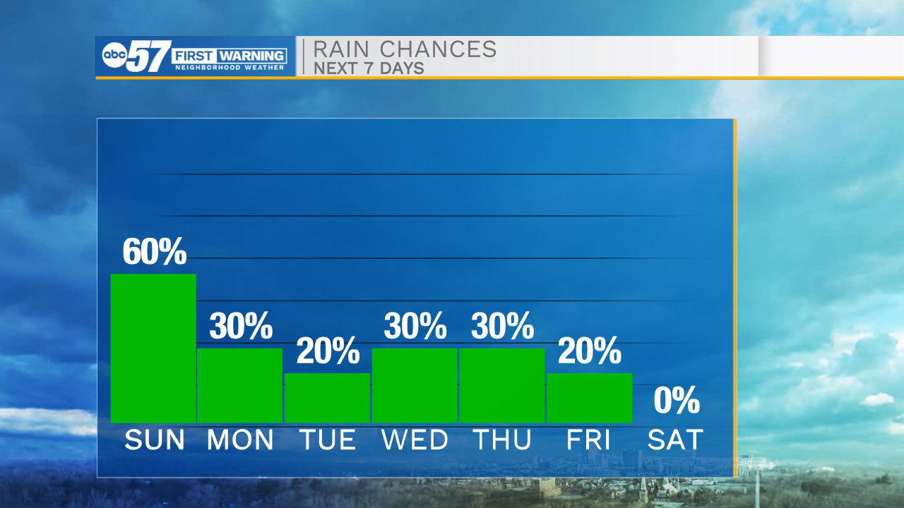
Scattered showers will remain off and on throughout the overnight hours. Low temperatures tomorrow morning will drop into the mid 60s. Sunday will be another rainy one for us across northern Indiana and southwest Michigan. Along with the rain cloud cover will remain in place, helping to keep high temperatures in the low to mid 70s. This system moving through the area will stall out to our east, allowing for more isolated to scattered showers to linger into Monday. It will finally clear into the middle part of the work week, but still isolated rain chances remain in the forecast. High temperatures throughout next week will top out in the mid 70s.
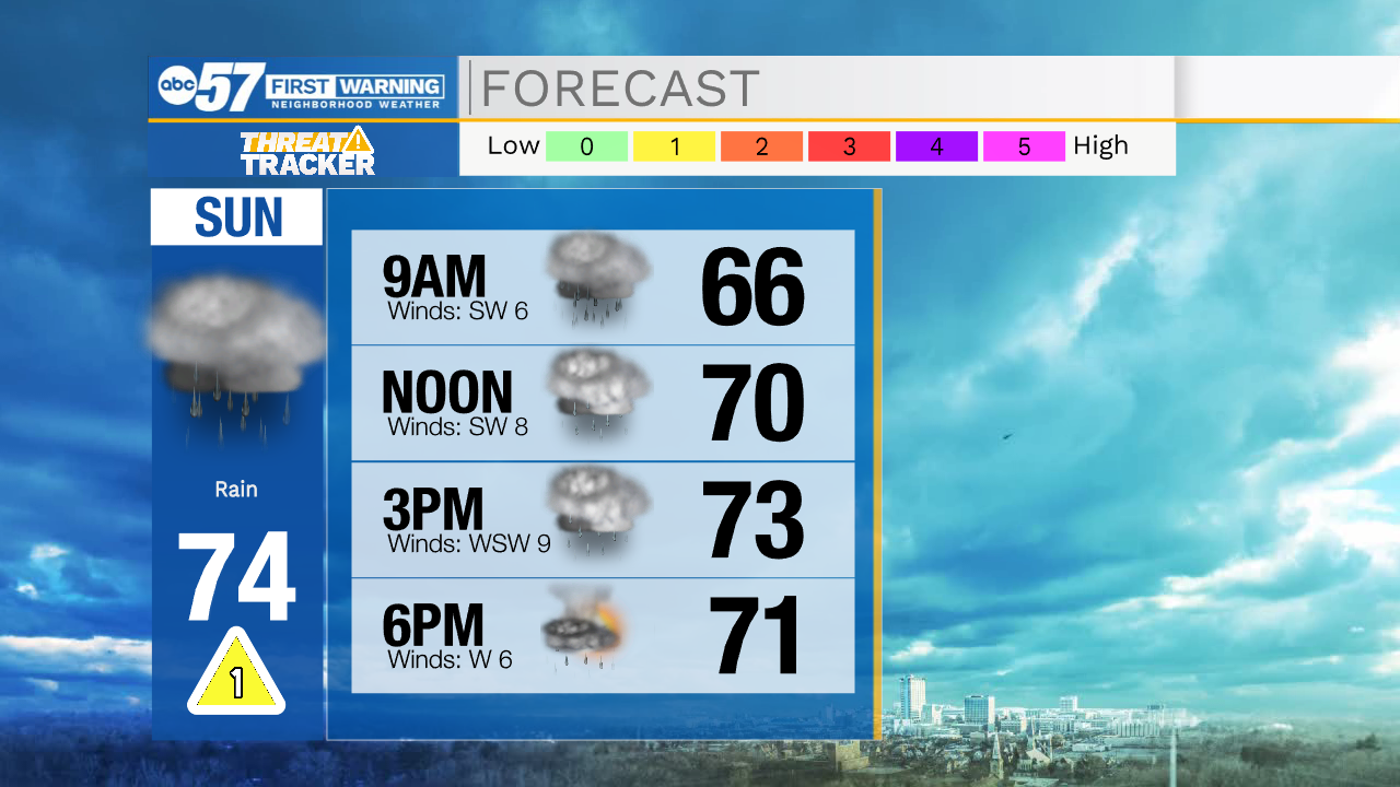
Tonight: Scattered showers. Low 65.
Tomorrow: Scattered showers. High 74.
Monday: Isolated showers. High 72.
Tuesday: Partly cloudy. High 74.