


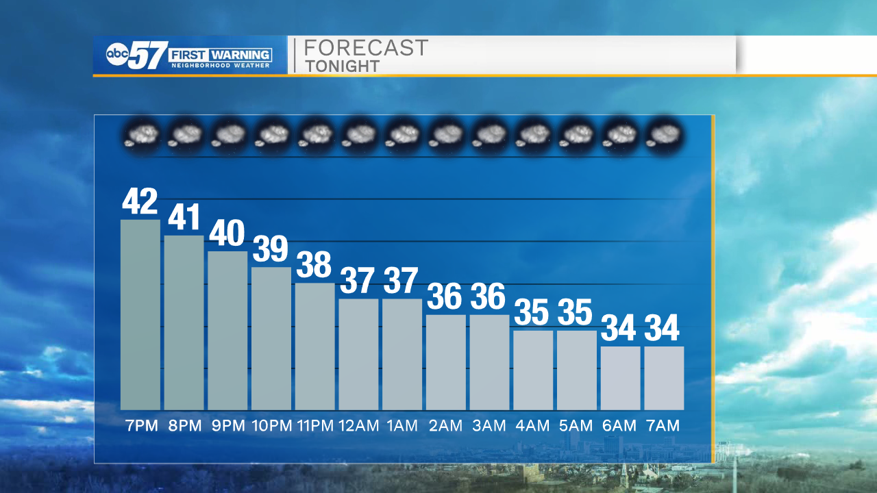
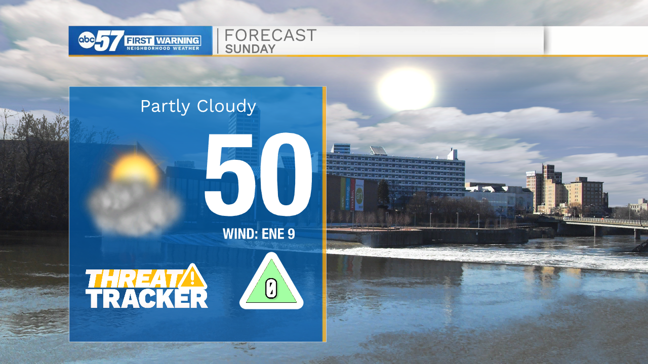
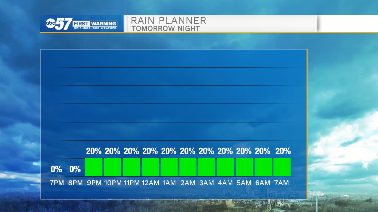
Partly cloudy skies and cold temperatures will stick around through the overnight hours. Lows tomorrow morning will be near freezing for most areas throughout Michiana. Cloud cover will increase throughout the day tomorrow, and high temperatures will only hit the upper 40s to lower 50s. Rain chances return to the forecast tomorrow during the late evening hours, and will increase into Monday morning. Scattered showers will stick around through Monday afternoon.
Dry weather is in the forecast for most of next week. Partly cloudy skies will give way to mostly sunny skies by Friday. High temperatures will hold steady in the lower 50s until next weekend. Finally, we are tracking dry weather for next Saturday and Sunday.
Tonight: Partly cloudy. Low 34.
Tomorrow: Mostly cloudy. High 50.
Monday: Scattered showers. High 48.
Tuesday: Mostly to partly cloudy. High 48.