


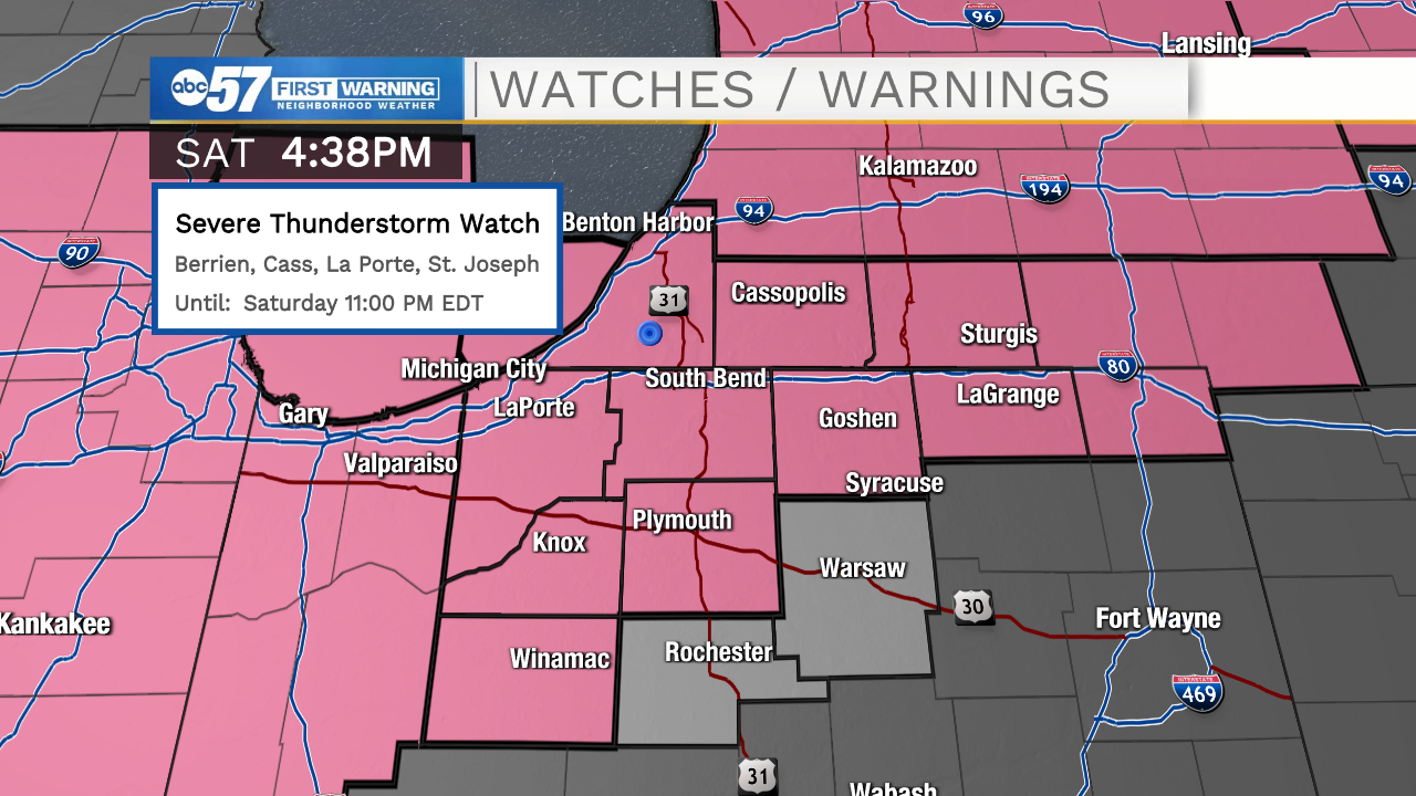
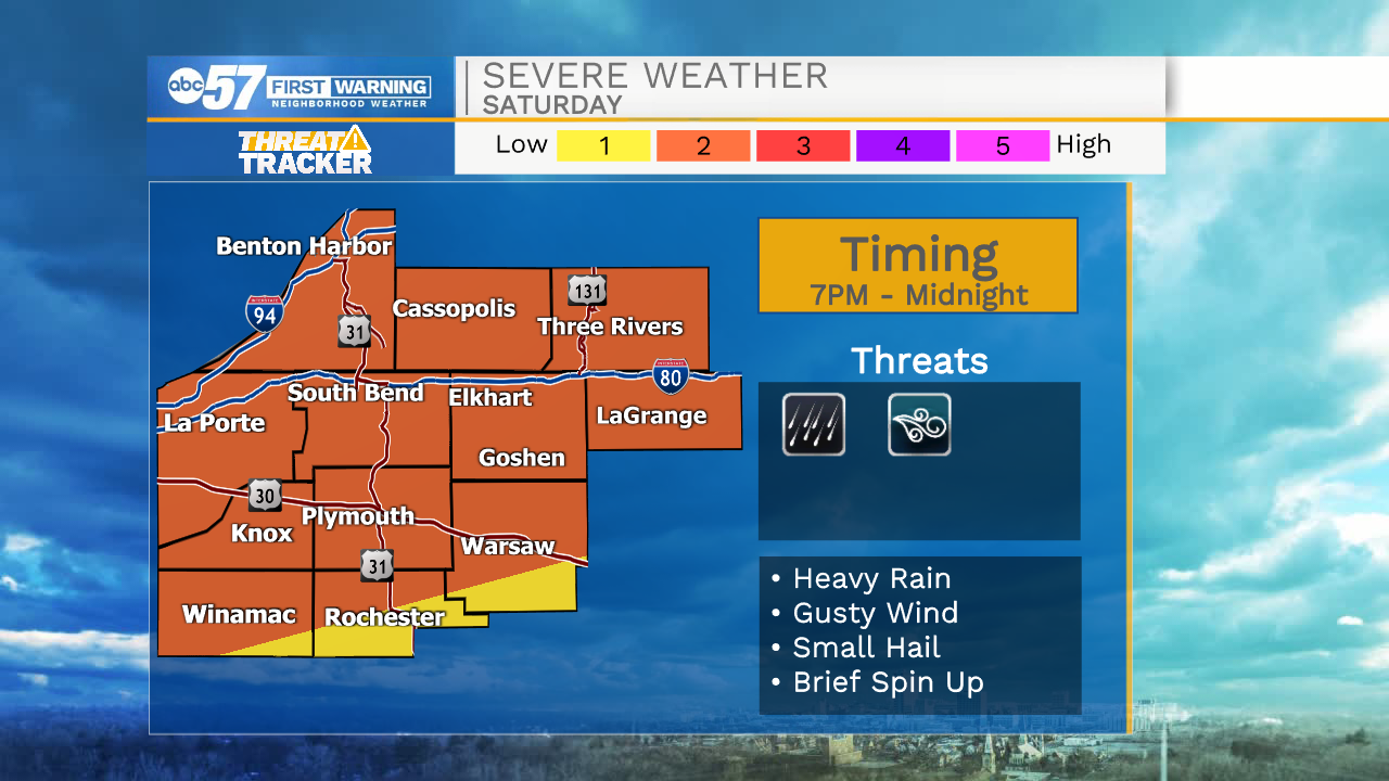
This evening a line of showers and storms will move in out of the north around 7-8pm. This line will bring a short round of rain and storms for everyone in Michiana. A few of those storms could be on the strong to severe side, with the main threat being gusty wind. Some small hail, heavy downpours, and a brief spin up of a tornado or two can’t be ruled out, but that threat remains very low. We will clear things out around midnight tonight, then we are talking dry weather and sunshine for the rest of the weekend and beginning part of next week. The heat and humidity will stick around for Sunday, but then moisture retracts south into next week. High temperatures the next few days will hold in the upper 80s to lower 90s.
Tonight: Scattered showers and storms. Low 70.
Tomorrow: Sunny. High 90.
Monday: Mostly sunny. High 90.
Tuesday: Mostly sunny/PM showers. High 90.