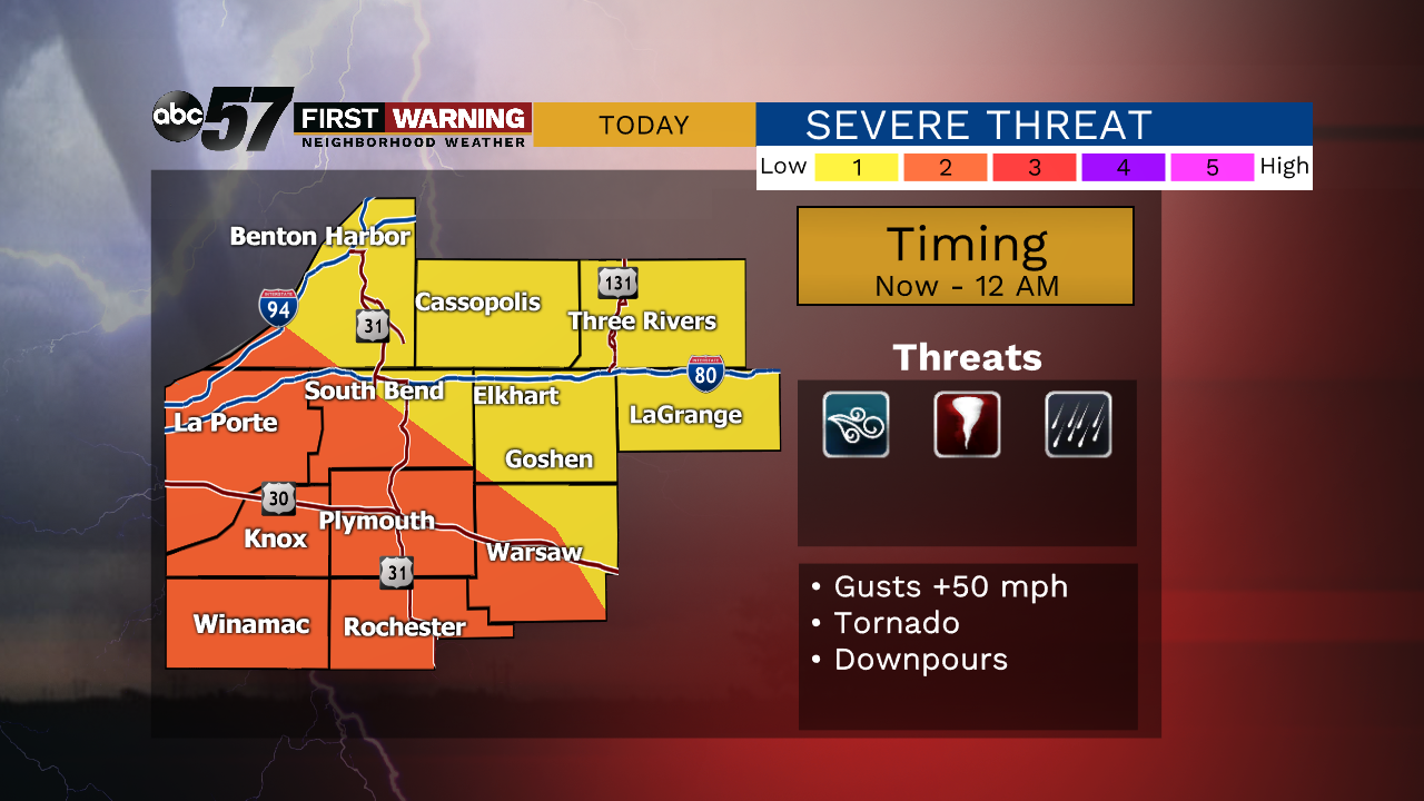
Scattered storms Tuesday evening even will produce localized heavy rain, gusty wind and the chance of a tornado. Widespread storm damage is not expected but power outages are possible. In addition to thunderstorm wind gusts, the sustained wind from the system is above 20 mph with gusts 30 to 40 mph. Total rainfall amounts could vary widely but upwards of a half inch is likely for many. The severe threat ends after midnight, lingering showers continue into the morning.
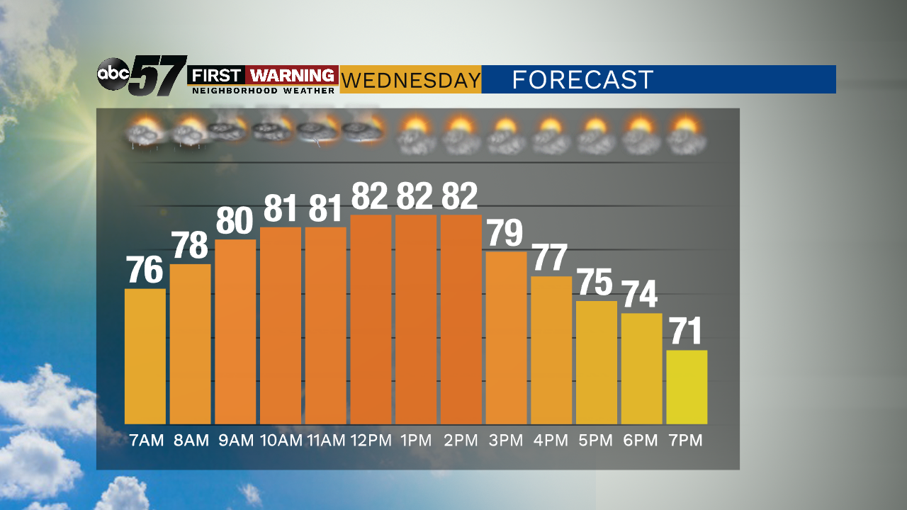
Wednesday will still be influenced by the storm formally known as Cristobal. Breezy with a chance of isolated showers / storms through early afternoon. The humidity drops and skies clear to end the week. The weekend is fair and mild, technically a bit cool for mid-June with highs in the low 70s. Temperatures slowly warm into next week but the most dominate trend is dry weather through next week.
Tonight: Windy. Scattered showers and storms. Low 74.
Wednesday: Breezy. Isolated storms through midday. High 82.
Thursday: Mostly sunny. High 76.
Friday: Sunny. High of 72.