
-
4:00

Witnesses share video from police confrontation at Central Park
-
1:35

Vandals hit four mausoleums at Crystal Springs Cemetery
-
0:54

The Extreme Heat starts today
-
4:22

From train tracks to highways, how Indiana became the “Crossroads...
-
0:45

The heat starts now
-
1:15

Showers and storms possible for the holiday weekend
-
2:46

Buchanan celebrates unity during fourth annual Pride event
-
1:53

Mishawaka celebrates America’s 250 with music
-
0:24

South Bend community donates blood at Grace UMC
-
1:23

Upgraded to an Extreme Heat Warning
-
1:35

Extreme Heat Watch begins tomorrow
-
0:21

One injured in overnight shooting on South Bend’s northwest...

Friday, the day is snow-free. Friday evening the storm begins with a burst of wet heavy snow. The snow transitions to sleet and rain after midnight. There is the potential for more than three inches of snow by early Saturday. However sleet and rain will compress that snow to slush and the cold ground will freeze that slush into an icy mess. Temperatures warm above freezing Saturday but slick conditions remain concerning through mid-morning. Temperatures tank again in Sunday, with a chance of lake effect snow.
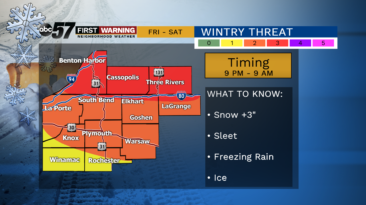
Tonight: Few clouds. Low of 16.
Friday: Mostly cloudy, snow late. High of 30.
Saturday: Wintry mix. High of 40.
Sunday: Lake effect snow showers. High of 16
TIMING IS KEY !!! This event is avoidable
Sign up for the ABC 57 Newsletter