


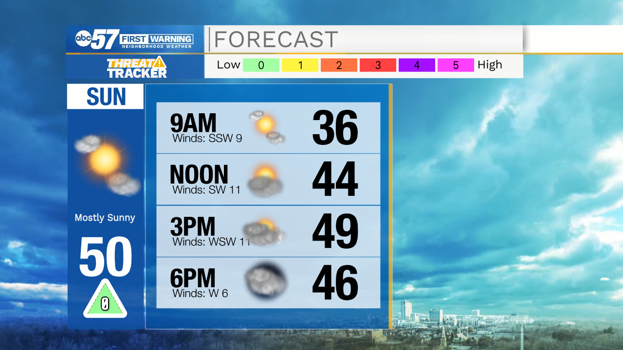
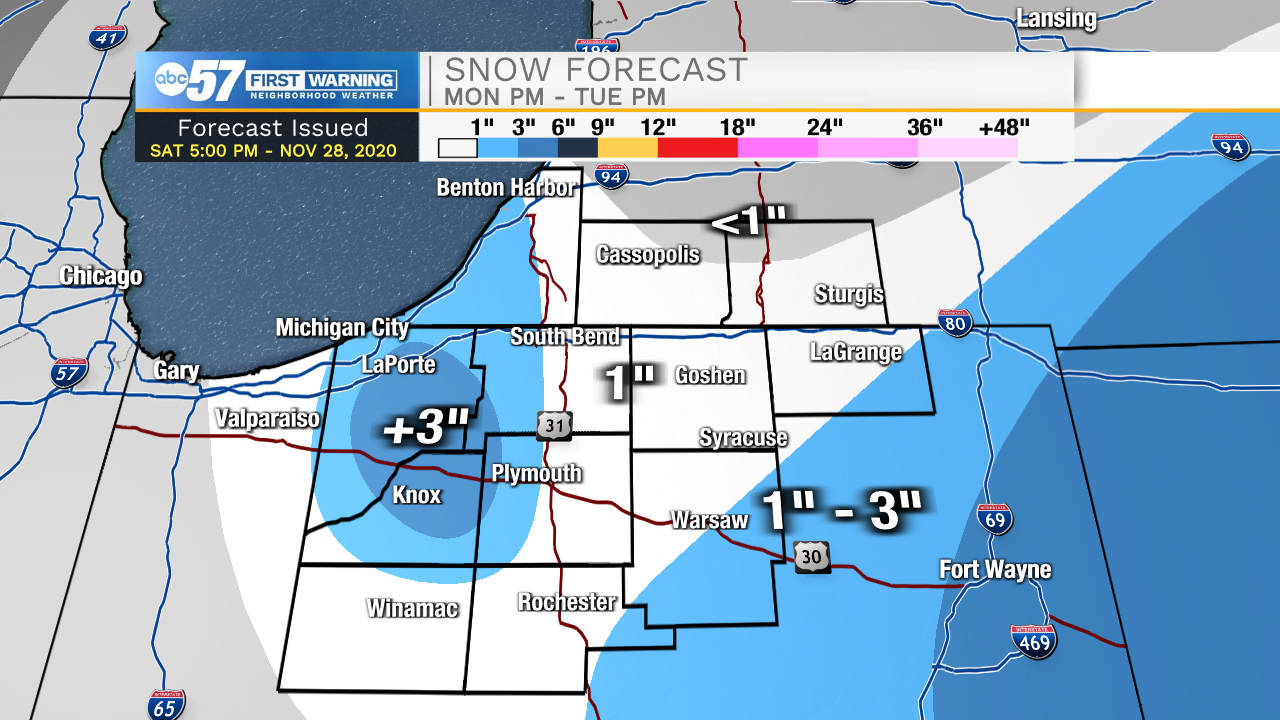
Clear skies will stick around tonight and through half of the day tomorrow. Temperatures tomorrow morning will be in the lower 30s with highs tomorrow afternoon around 50. Cloud cover will increase tomorrow afternoon and evening. Our next system will arrive during the early morning hours Monday bringing snow showers into our southern and eastern Michiana counties. Eastern Fulton, Kosciusko, southeastern Elkhart, and LaGrange counties could see 1-3”. Lake effect snow showers will develop by mid to late morning bringing increased snow chances for LaPorte, Starke, western St. Joseph, and Berrien counties. Lake effect snow totals will range 1-3 inches from late Monday morning into Tuesday.
Low temperatures Wednesday, Thursday, and Friday morning will drop into the mid 20s with highs topping out in the upper 30s to lower 40s. Another round of rain and snow showers look possible Friday and Saturday morning.
Tonight: Clear. Low 32.
Tomorrow: Mostly clear. High 50.
Monday: Snow showers. High 36.
Tuesday: Isolated snow showers. High 36.