


Get out the door a few minutes early. You may need to scrape snow off your car, driveway, or sidewalk before heading into work. While accumulations are low, it could still mean a few slick spots on your morning drive.
Snow showers wrap up early this morning, then most of the day itself is dry.
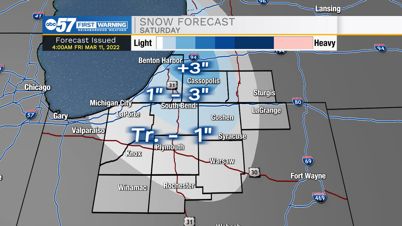
A second round of snow starts late overnight/early Saturday morning. A few additional inches of this lake effect snow could accumulate on Saturday.
It is bitterly cold – wind chills throughout the day tomorrow are in the single digits, with wind gusts 25-30 mph.
Sunday is windy but warmer, with temperatures improving near 50. Sunday will definitely be the better day to get outdoors over the weekend.
Next week, temperatures look to stay in the 50s, even 60s.
Reminder: Daylight Saving Time begins at 2:00 a.m. on Sunday, March 13. We spring forward one hour.
Today: Snow ending. Becoming windy. High 36.
Tonight: Lake effect snow showers late. Low 16.
Saturday: AM lake effect snow showers. Windy and cold. High 22.
Sunday: Mostly sunny. Windy and warmer. High 50.