
-
4:21

ABC57 announces the Jennifer Copeland Memorial Scholarship Fundraising...
-
1:05

Notre Dame’s Comfort K9 program is breaking down barriers,...
-
2:23

Notre Dame softball rallies past DePaul in regular-season finale
-
3:04

Berrien County Community asks Sheriff to withdrawal from partnership...
-
3:33

Notre Dame alum crucial part of Artemis II mission
-
1:55

The UAE is leaving OPEC soon, here’s why
-
3:02

City of Benton Harbor facing “dire“ financial situation
-
3:17

Shawn Akison sentenced to 12 years for 2025 multi-vehicle crash...
-
5:24

Mayor Mueller discusses the questions of data centers and spring...
-
2:01

South Bend Cubs open 12-game homestand with win over Fort Wayne
-
1:11

Cloudy and cool weather today
-
4:40

Ivy Tech South Bend-Elkhart serves up food rescue program

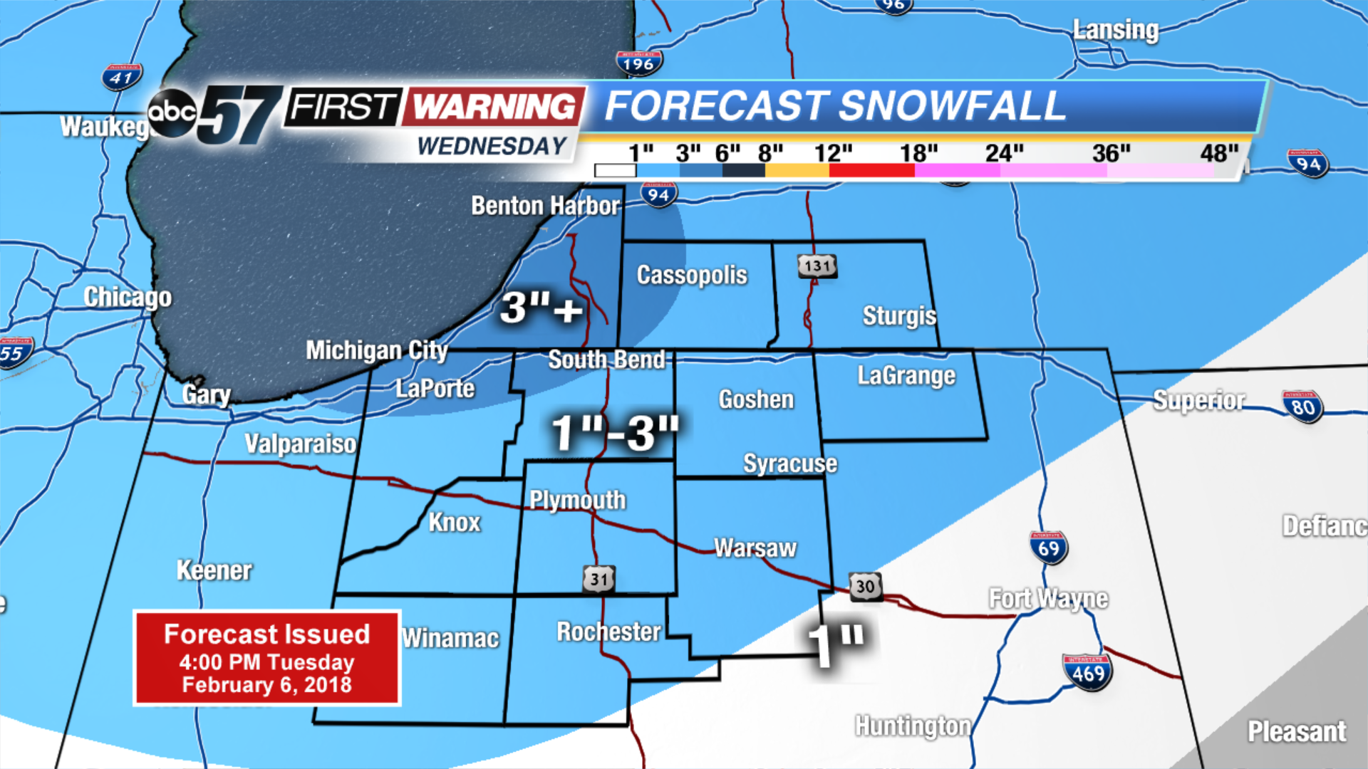
Another round of snow starts after midnight, this will have a bigger impact on travel as it lasts through the morning drive Wednesday
Wednesday will start with widespread snowfall, then transition to scattered lake effect snow showers in the afternoon. Many will see around three inches of accumulation with the highest amounts near the lake. A lull Thursday, before more snow Friday and this weekend. Each round of snow is likely to bring around three inches of snow. The snowy pattern shows signs of breaking next week.
Tonight: Snow starts after midnight, low of 16.
Wednesday: Snow showers, high of 22.
Thursday: Mostly cloudy, chance of snow late, high of 20.
Friday: Snow showers, highs in the upper 20s.
Sign up for the ABC 57 Newsletter