
-
10:47

ABC57 speaks with political science professor ahead of Pres....
-
1:17

Cold and soaking rain today, another severe risk tomorrow
-
0:44

South Bend High School Music Festival highlights student talent
-
1:55

South Bend house fire possibly caused by lightning
-
2:26

Flooding remains a threat into Wednesday
-
0:40

Baxmeyer defends actions amid solar farm bond debate
-
2:11

Southwest Michigan Cares Fund reaches over $70k as families still...
-
1:35

Severe weather threat ending across Michiana
-
0:51

SJCPD responds to AG’s appeal of lawsuit dismissal
-
2:13

More strong storms likely this evening
-
2:15

The ingredients for severe weather
-
2:14

Why summer travel prices may spike due to the ongoing war in...

They severe threat is lowering, but thunderstorms are still likely. There is limited energy for storms to ramp-up to severe, and clouds ahead of the storms will only continue to reduce that factor. Plan on a round of rain this evening with thunder and lightning. There still could be severe weather, straight line wind, even a tornado but that threat is likely isolated.
Temperatures start to cool this week, 70s through midweek and 60s by the weekend. The next fall front hits Thursday into Friday with rain likely. This weekend is fair and much cooler, highs in the 60s.
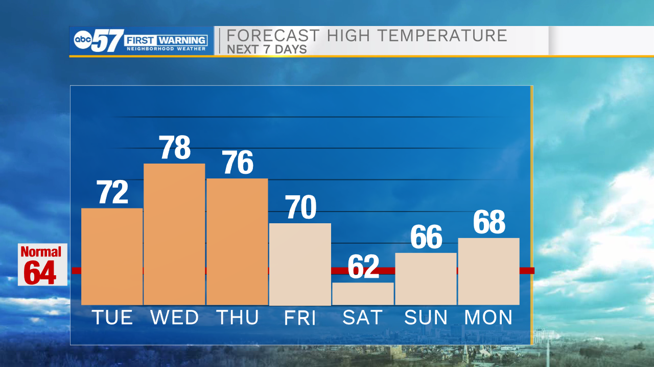
Tonight: Scattered thunderstorms. Low 60.
Tuesday: Mostly to partly cloudy. High 72.
Wednesday: Partly cloudy. High 78.
Thursday: Rain showers. High 76
Sign up for the ABC 57 Newsletter