


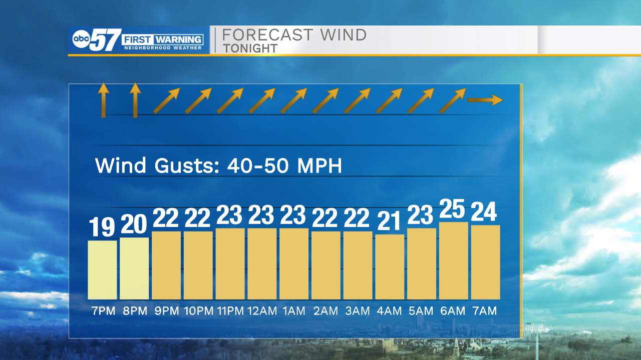
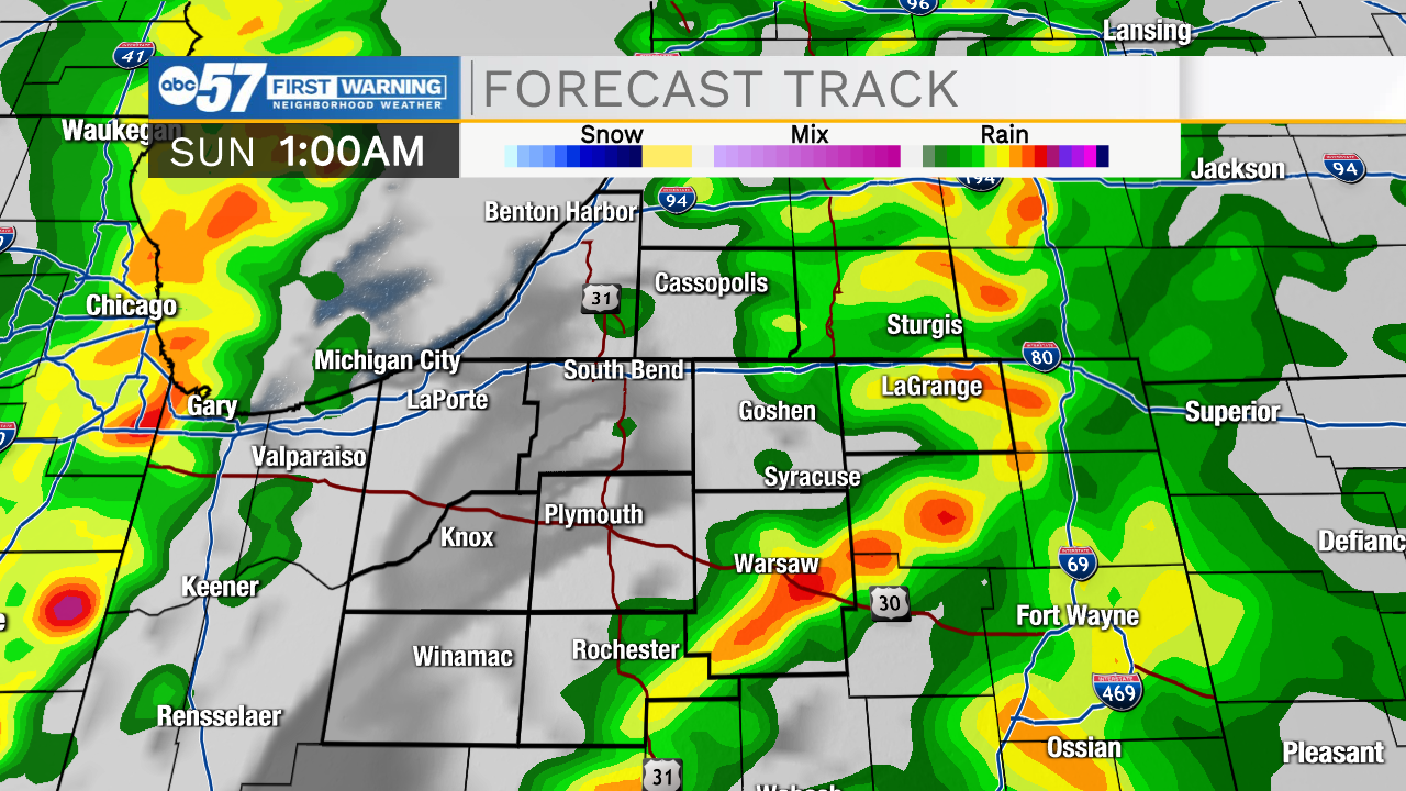
This morning temperatures are on the mild side with some breezy winds. We will see highs hit the upper 60s today and potentially the lower 70s in southern Michiana. Hopefully your able to get outside to enjoy the nicer weather. Tonight a few thunderstorms and rain showers are likely here in Michiana. A few of those storms could be on the stronger side as we head into early Sunday morning. Along with the storms, winds will become very strong. There is a wind advisory in effect from 10pm this evening until 11am tomorrow morning. Wind gusts will range from 40-50mph in a few areas throughout Michiana. We will catch a break from the rain throughout most of your Sunday but then more showers return Sunday night into Monday. Some of that rain will turn to snow Monday morning. Snow accumulations look very limited. Temperatures will rebound back into the 40s and 50s as we head towards the middle part of next week.
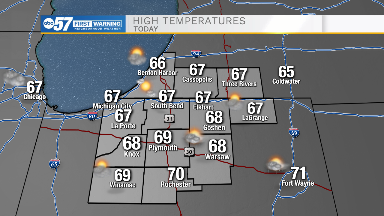
Today: Windy/warm. High 67.
Tonight: Thunderstorms/strong winds. Low 54.
Tomorrow: Windy. High 50.
Monday: Rain/snow. High 38.