
-
1:14

Widespread showers and downpours this morning ahead of warm front
-
1:48

Preparations underway as Indiana University football trophies...
-
3:09

Indiana Utility Regulatory Commission collecting consumer data...
-
1:18

St. Joseph County officials host Election 101 Workshop on voting...
-
5:36

Hannah Hidalgo wins Naismith Defensive Player of the Year
-
2:50

New South Bend Cubs manager Daniel Wasinger ready for opening...
-
2:24

South Bend Cubs pitcher Kenten Egbert looks to build on strong...
-
1:52

Hoosiers face a gas tax increase as gas prices continue to rise
-
1:45

Iranian cybercrime group claims to have hacked St. Joseph County’s...
-
1:17

Cold and soaking rain today, another severe risk tomorrow
-
0:44

South Bend High School Music Festival highlights student talent
-
1:55

South Bend house fire possibly caused by lightning

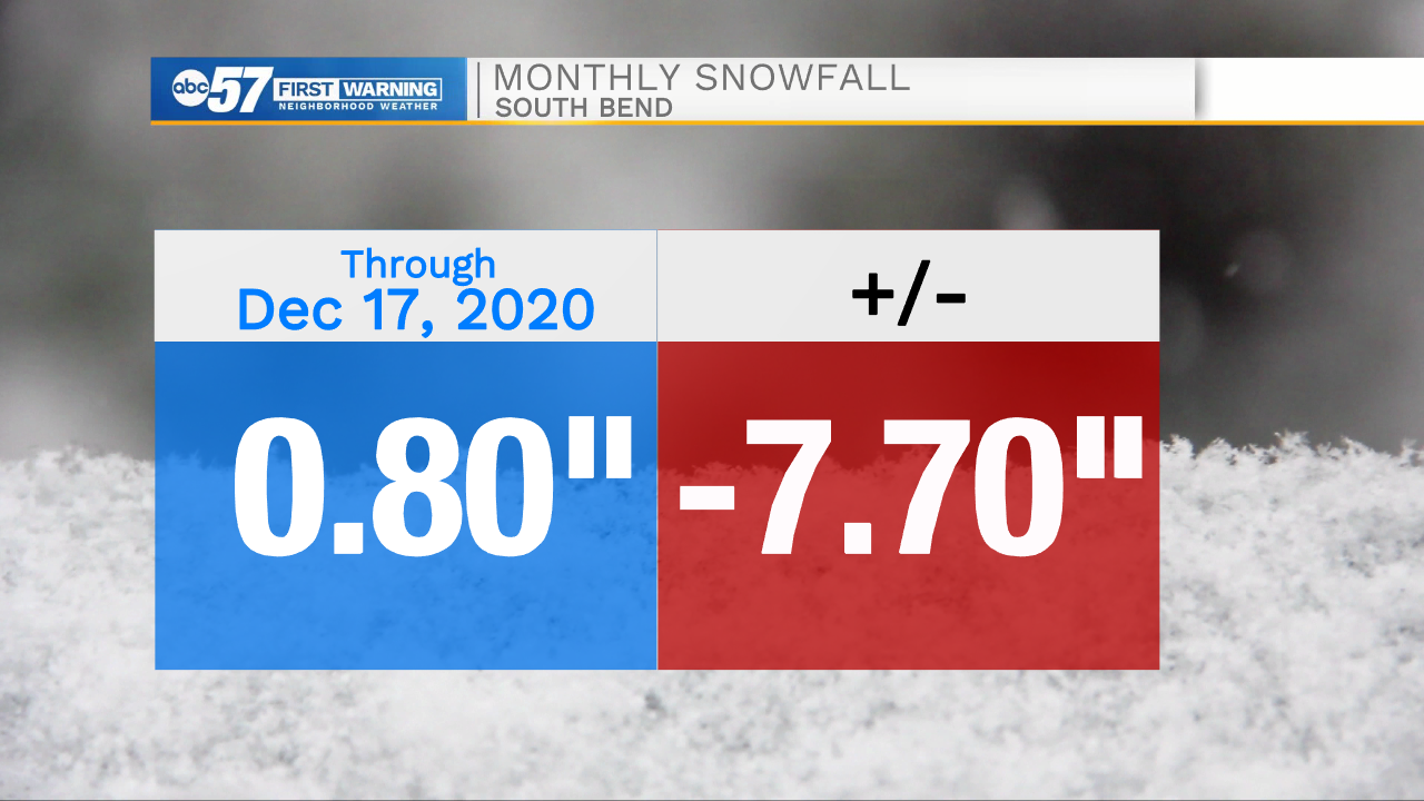
The gloomy weather continues, Friday morning is our best chance to see a little sunshine before clouds fill-in again by the afternoon. Saturday is the next round of wintry weather. Models are split slightly on timing, but the greatest consensus has precipitation starting in the afternoon and lasting through the evening. That scenario would mean rain, mix then some snow, with little accumulation. An earlier arrival would not change the end result much, precipitation could as snow then change to rain before switching back to snow. Next week is milder with highs in the 40s before a cold blast Christmas Eve that could bring some lake effect snow showers.
Tonight: Mostly to partly cloudy. Low 24.
Friday: Partly cloudy. High 36.
Saturday: Rain/snow showers. High 40.
Sunday: Mostly cloudy. High 38.