
-
1:06

Marshall County Humane Society reschedules Dog Egg Hunt
-
2:01

Martin Luther King Dream Center hosts MLK March in South Bend
-
1:54

South Bend Cubs opener postponed by weather, but fans still find...
-
2:01

Sights and sounds from South Bend Cubs Opening Day
-
1:32

NIPSCO ’flatly rejected’ further negotiations, USW workers...
-
3:36

The art of groundskeeping at Four Winds Field
-
3:32

The history behind America’s only ballpark synagogue turned...
-
1:59

South Bend opens season against Quad Cities in familiar Midwest...
-
4:21

South Bend Cubs owner discusses $48M stadium expansion, changes...
-
3:19

A look into the new South Bend Cubs 2026 roster
-
5:17

Expansion goes beyond Four Winds Field, new restaurants, bars,...
-
6:18

What’s new this season? South Bend Cubs unveil major improvements...

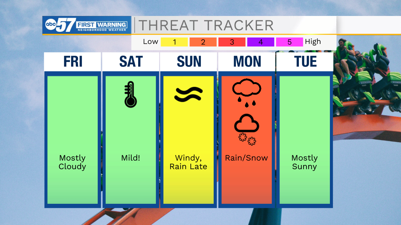
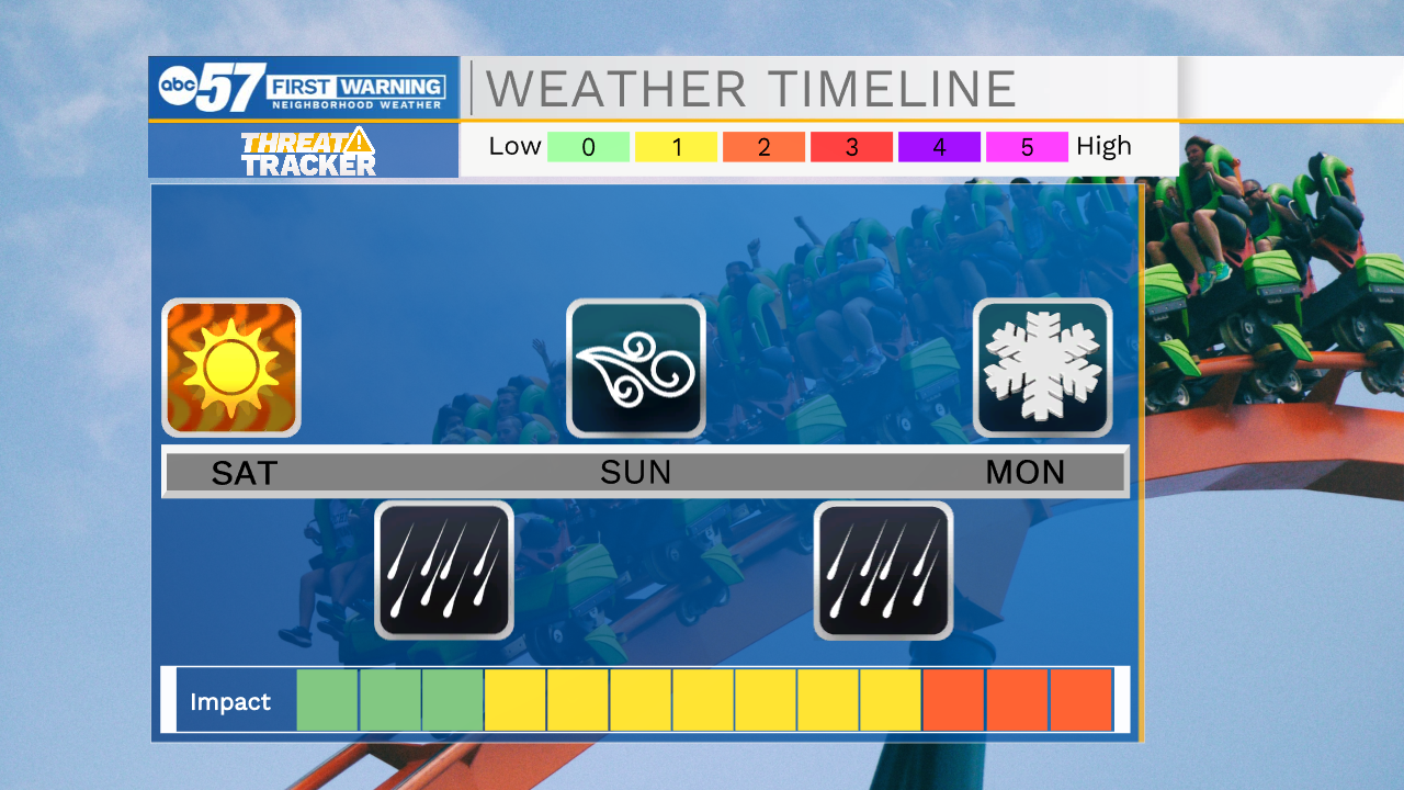
The rollercoaster ride is just beginning. Temperatures start to climb Friday, and surge Saturday ahead of early spring storm system. Highs could peak near 70 Saturday. Then light rain Saturday night - early Sunday with the cold front. Wind gusts as temperatures fall through Sunday. Sunday night a secondary system brings widespread, that changes to a wintry mix by Monday morning. The most impactful period now looks to be Sunday night through Monday. Snow accumulation is possible Monday, but the ground will be warmer.
Tonight: Partly cloudy. Low 24.
Friday: Partly cloudy. High 44.
Saturday: Mostly cloudy and breezy. Rain late. High 67.
Sunday: Windy, Temperatures falling form 57, rain late.
Monday: Rain/snow showers. High 38.
Sign up for the ABC 57 Newsletter