Tonight's temperature drop a preview of later this week

-
2:00

A sunny Monday ahead, rainy almost every other day this week
-
2:59

Dusty May leads Michigan back to Final Four with dominant win...
-
0:37

Vendors and cosplayers showcase art at South Bend Anime Fest
-
3:06

Palm Sunday procession in South Bend unites faiths in call to...
-
0:48

2026 Auto Show brings crowd to Century Center Sunday
-
2:34

Warm to start the week, Rainy week ahead
-
2:44

Warmer, breezier, and cloudier than yesterday
-
0:46

Crowds gather for Fins and Feathers Fest at La Porte City Fairgrounds
-
0:46

Paramount School of Excellence hosts teacher fair
-
2:30

Voting advocacy, peaceful demonstrations and donations: South...
-
2:04

Warming to start the week, Showers and storms by Tuesday
-
2:10

Cool, but calm, today

There will be a quick drop from 70s to 50s this evening as a cold front brings rain showers and a few scattered thunderstorms. Severe weather is unlikely.
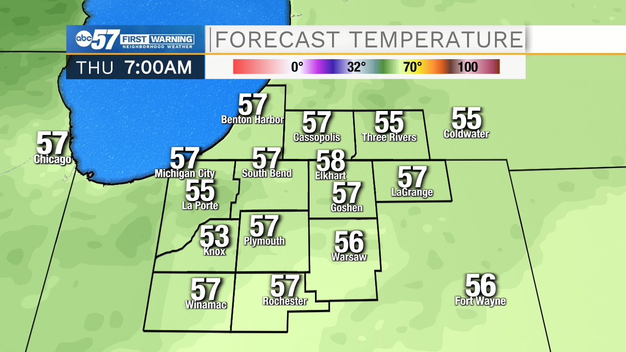
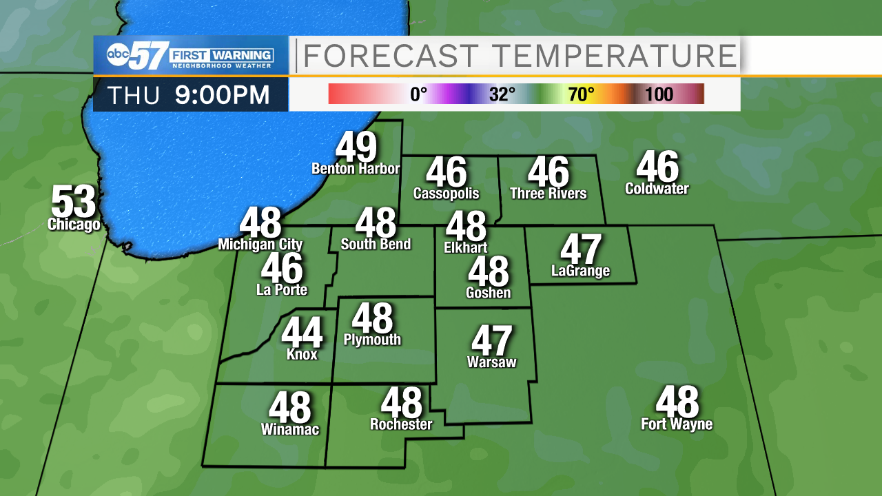
Enjoy the sunshine and mild temperatures Tuesday and Wednesday. The fall chill is on the way. Thursday is the day of drastic change and temperatures fall from 55 early in the day and end up lower 40s by the evening. A chilly northwest breeze could also produce a few rain showers. The end of the week is much cooler, highs struggle to reach 50 with lows in the 30s. Fall color will peak this weekend.
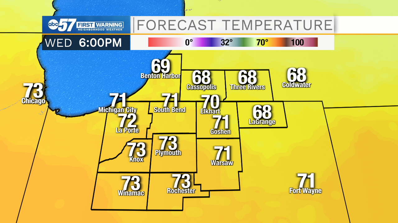
Tonight: Evening showers, clearing and cool. Low 42.
Tuesday: Sunny; breezy. High 70.
Wednesday: Mix of clouds and sun. Breezy. High 70.
Thursday: Temperatures fall from 55, breezy with a few showers possible.