


Today we are expecting a round of system snow through the course of the day. After the system moves out, parts of Michiana will see additional lake effect snow from tonight into Tuesday morning.
The system snow today starts after 6 a.m., so the morning commute may be slow going. Most of Michiana will pick up 1-2” of snow, while some areas could pick up 3-4” of snow by this afternoon.
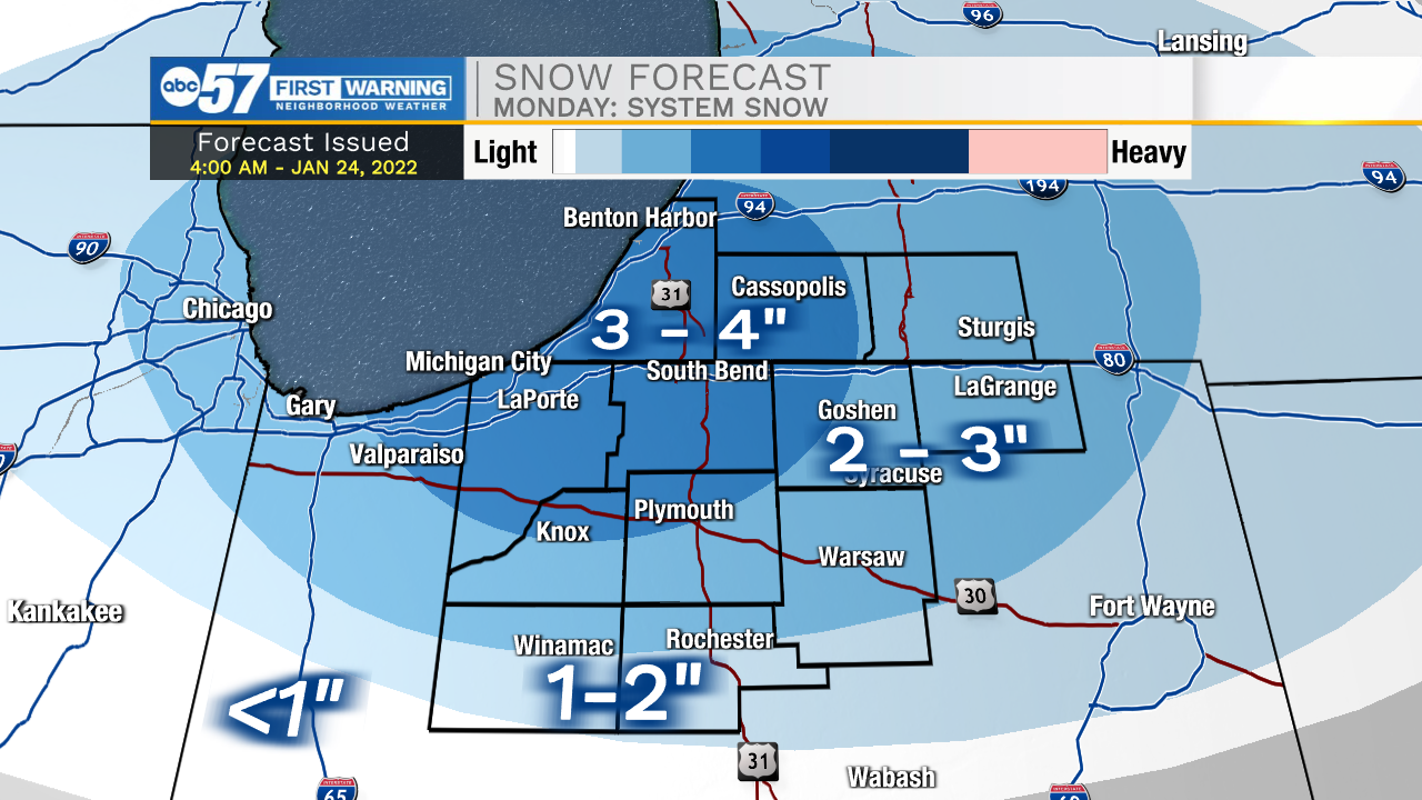
Lake effect snow begins this evening after 6 p.m., and will linger into late Tuesday morning. LaPorte and St. Joe Counties in Indiana, in addition to Berrien and Cass Counties in Michigan, could pick up an additional 2-4” of lake effect snow by Tuesday.
As far as temperatures go – today may be the warmest day of the week. Bitter cold arrives Tuesday overnight with a low of 4 degrees. Wednesday’s high is just 14 degrees, and Wednesday night drops to 2 degrees. It’s still cold to end the week, but not as frigid.
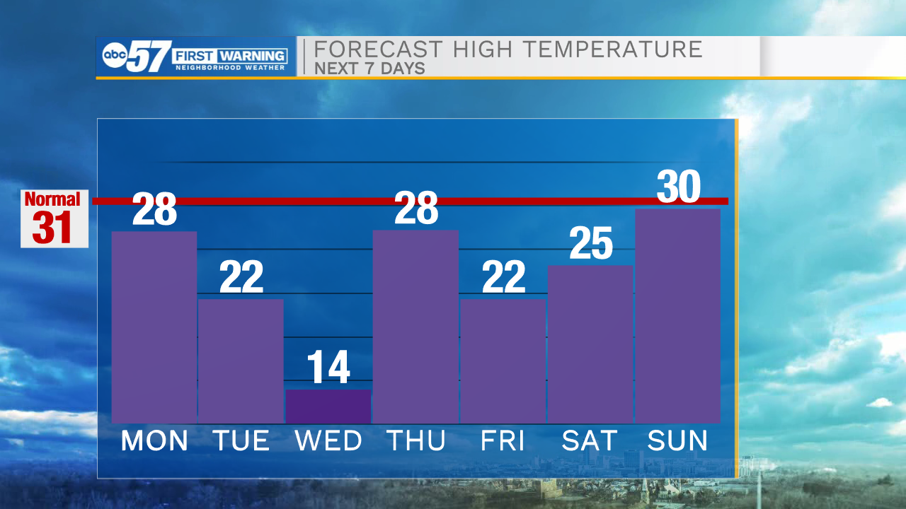
Today: Snow showers. High 28.
Tonight: Lake effect snow. Low 15.
Tuesday: Lake effect snow. High 22.
Wednesday: Partly cloudy and cold. High 14.