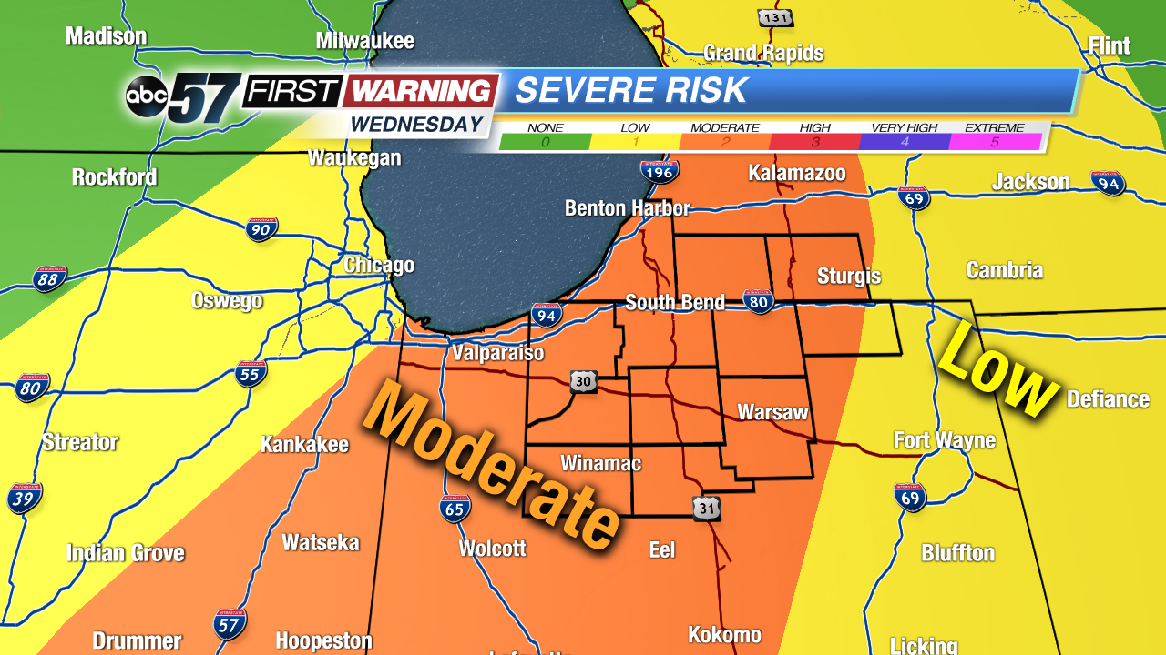
Michiana area is under a "Slight Risk" (level 2 of 5) for severe weather on Wednesday. This is the first time in 2018 that the severe threat has been that high for the entire area. However, it is highly unlikely that everyone will see severe weather. What the outlook from the Storm Prediction Center means is conditions look supportive of scattered strong to severe storms capable of mainly damaging winds and heavy rain. There is, though, a threat for some hail and an isolated tornado or two.
The time in which the severe threat is highest is 5-10 PM Wednesday evening. A strong storm is possible both before and after this window, but the most widespread thunderstorm activity is likely from 5-10 PM. Most variables and parameters that meteorologists look into when forecasting and predicting the threat for severe weather are moderate to high. There will be sufficient warmth as we approach 80°, moisture and a cold front sliding through the region.
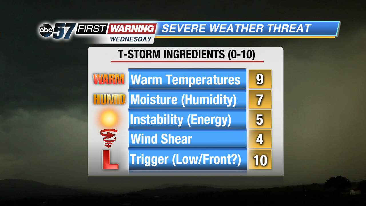
The potential limiting factors are instability and wind shear, or turning of winds with height. Both will be present to some degree, but whether or not they will be sufficiently high enough for severe thunderstorms is still in question. If we can squeeze out some sunshine Wednesday afternoon, then temperatures will push 80° and the surface will heat up significantly. If that happens, the instability (energy for thunderstorms) will more prominent. If clouds remain intact throughout the day and little sunshine is seen, the amount of instability we will have will be much lower. That, in turn, means a reduced severe weather threat. When analyzing wind shear, the amounts expected to be in place aren't exactly overwhelming. They will be high enough, though, to support some strong and severe thunderstorms.
Will this event be a severe weather outbreak? No. But there will likely be at least one or two storms capable of damaging wind gusts and marginally severe hail to 1" in diameter. Be sure to download the ABC 57 First Warning Neighborhood Weather app and to continue checking in with ABC 57 for more updates as the threat moves closer.