
-
3:41

Present Pillars to host “Dad Strong 5K“ to support fathers...
-
1:44

Warming up through Wednesday
-
2:34

From Niles to South Bend: Jays 2 Keeps the Spirit Alive for basketball...
-
0:46

44th annual Tri Kappa Antique Show boosts charities and scholarships
-
1:48

Scattered showers this evening, Much cooler overnight
-
1:50

Showers and storms this afternoon
-
0:20

One person injured in shooting
-
0:36

Eddies Circuit Robotics holds competition Saturday
-
0:32

21st annual Nappanee Model Train Show
-
0:38

Local boys basketball team headed to IHSAA state finals
-
3:49

Midwest Meowfest brings kitten advocacy to attendees, new homes...
-
1:52

Mild tonight, showers tomorrow

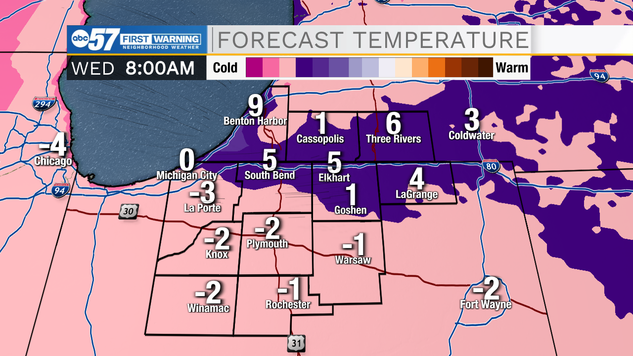
Wednesday is the coldest day of the season, lows near zero, highs struggle to reach the double digits and a wind chill below zero. There is a reprieve of the frigid weather Thursday, but the bitter colds last through the weekend. Next week, the focus could turn to a very messy set-up, if temperatures warm and rain falls, there is concern for ice and possibly flooding.
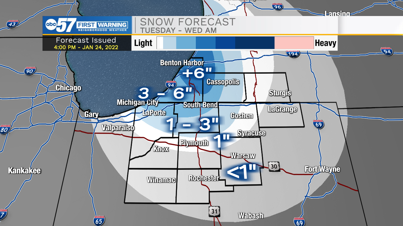
Tonight: Cold with lake effect snow. Low 2.
Wednesday: Cold and clearing. High 12.
Thursday: Mostly cloudy. PM snow showers. High 30.
Friday: Partly cloudy. High 20.
Sign up for the ABC 57 Newsletter