Winter Storm then brutally cold


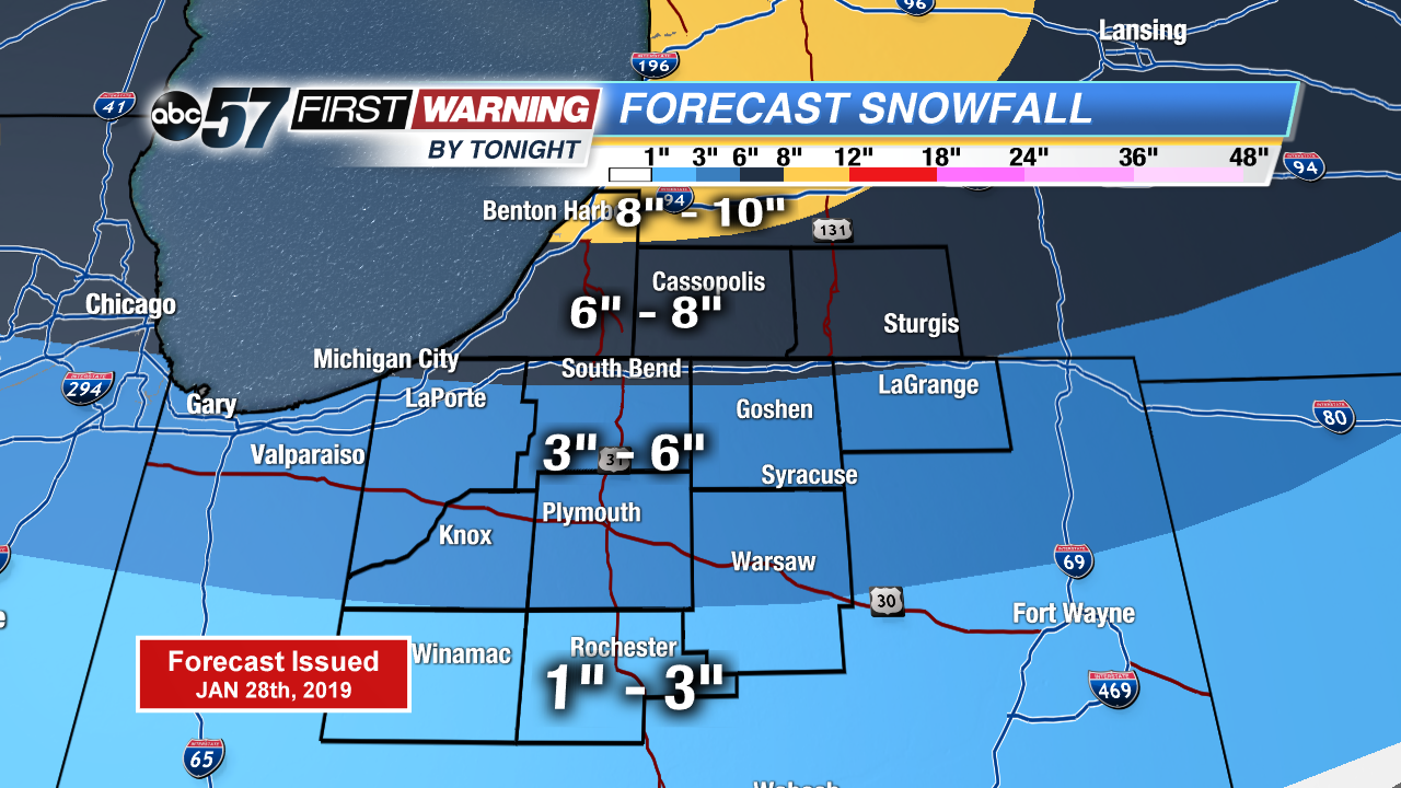
The winter storm has started to move into our area. Snow will start out lighter but pick up in intensity heading throughout the morning. The heaviest snow is expected in our Michigan counties where 6-9” of snow is possible. Snowfall totals will quickly drop off for our southern counties as a brief period of snow/mix is possible. Travel will be very slow and rough at times. The system begins to move out tonight but lake effect snow quickly develops.
As this system heads east, brutally cold air will wrap in behind it. Temperatures will from the mid-teens on Tuesday with possible record cold highs for Wednesday. It is VERY important that you are dressing warm and limiting time outdoors as temperatures and wind chill will be dangerously cold. Temperatures start to make it back into the teens Friday. Lake effect snow continues through Thursday.
Today: Snow, heavy at times, slight chance mix south of US-30. Breezy. High of 33.
Tonight: Snow system ends, lake effect snow begins. Low of 12.
Tuesday: L.E. snow showers, breezy. Temperatures falling from the mid-teens.
Wednesday: L.E. snow showers, dangerously cold. High of -9.