
-
2:00

Annual Studebaker car show takes over Ironwood Plaza
-
0:55

Beautiful weekend expected
-
1:05

Truly wonderful conditions
-
0:41

One person left with serious injuries after high-speed pursuit...
-
2:15

Fort Wayne Tin Caps put an end to the SB Cubs winning streak
-
1:21

This weekend is the annual Hall of Heroes Comic Con
-
0:46

Elkhart Police Department respond to shots fired call at the...
-
3:55

ABC57 speaks with Cass County Commissioners, Judge and Interim...
-
2:48

Common Council to consider appeal options following South Bend...
-
0:52

South Bend seniors explore local parks, event centers, and available...
-
1:51

Mentone Egg Fest celebrates 80th year
-
4:58

New reactions after Notre Dame releases findings of priest sex...

Winter weather comes roaring back to Michiana. Temperatures will drop sharply tonight as rain changes to sleet and snow. Slick roads are the top concern, overall snow accumulation may be at a minimum but don’t let your guard down as ice is the main concern, after previous salt treatments are washed away.
Snow showers come to an end by midday Friday but temperatures won’t get any warmer. Temperatures drop into the teens with light lake effect snow showers near the lake Friday night into Saturday. The cold last through the weekend with another round of snow Monday.
Tonight: Rain changing to wintry mix and snow, low of 26. 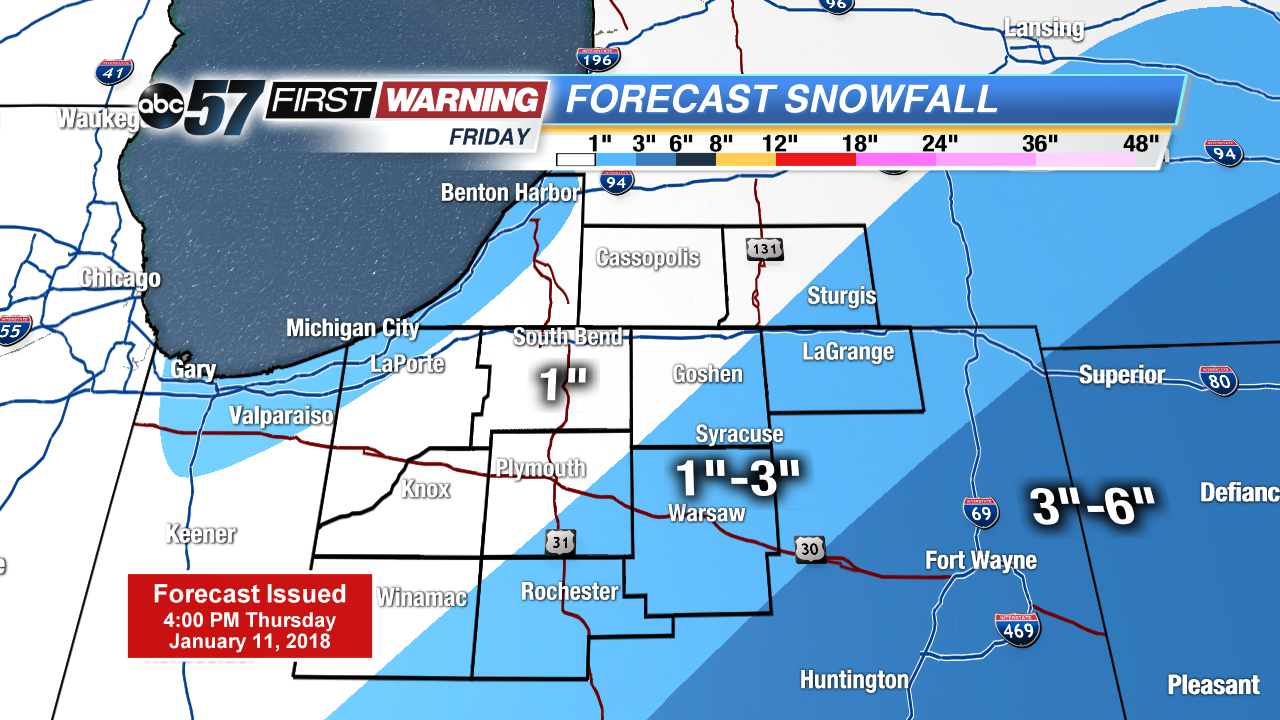 System snow Frday
Friday: Morning snow showers, high of 28.
Saturday: Mostly cloudy, lake effect snow showers, high of 20.
Sunday: Partly cloudy, high of 18.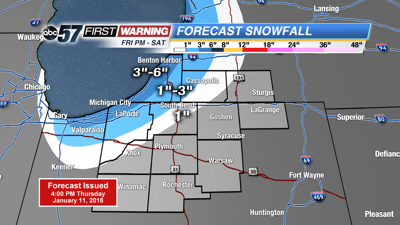 Lake effect snow Friday night through Saturday