
-
1:14

Widespread showers and downpours this morning ahead of warm front
-
1:48

Preparations underway as Indiana University football trophies...
-
3:09

Indiana Utility Regulatory Commission collecting consumer data...
-
1:18

St. Joseph County officials host Election 101 Workshop on voting...
-
5:36

Hannah Hidalgo wins Naismith Defensive Player of the Year
-
2:50

New South Bend Cubs manager Daniel Wasinger ready for opening...
-
2:24

South Bend Cubs pitcher Kenten Egbert looks to build on strong...
-
1:52

Hoosiers face a gas tax increase as gas prices continue to rise
-
1:45

Iranian cybercrime group claims to have hacked St. Joseph County’s...
-
1:17

Cold and soaking rain today, another severe risk tomorrow
-
0:44

South Bend High School Music Festival highlights student talent
-
1:55

South Bend house fire possibly caused by lightning

Temperatures warm through Wednesday, a quick melt as highs spike to 50 Wednesday. The melt will be added to by heavy rain Wednesday night, before temperatures fall through Thursday. Standing water and minor flooding is the biggest concern, followed by the refreeze Thursday night, when temperatures fall into the teens. Wednesday afternoon through Thursday is the most impactful weather this week. The weekend is fair and quiet.
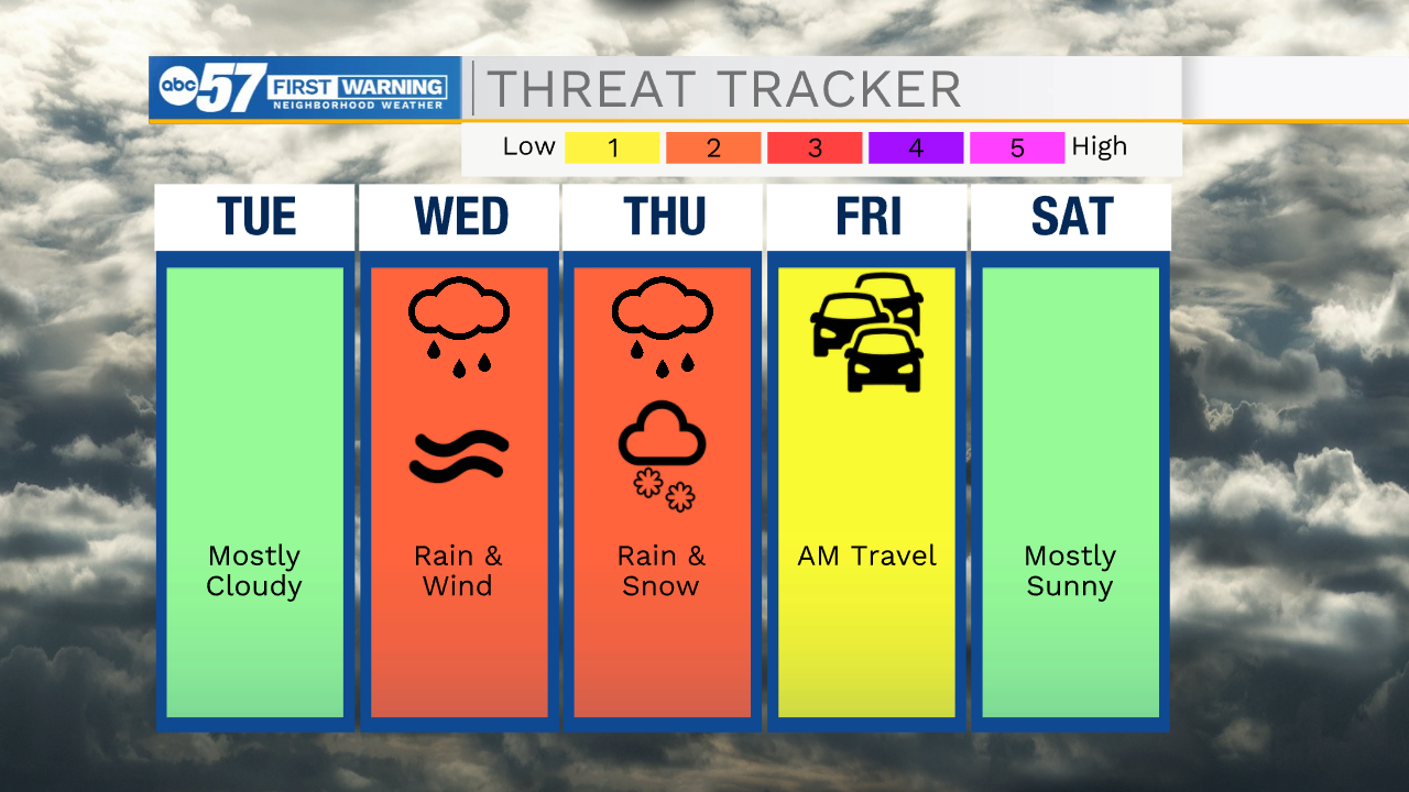
Tonight: Partly cloudy. Low 14.
Tuesday: Partly cloudy and breezy. High 36.
Wednesday: PM rain and windy. High 50.
Thursday: Falling temperatures, rain/snow showers.
Sign up for the ABC 57 Newsletter