-
1:26

Amidst several rounds of storms, some could be severe today
-
0:34

South Bend Community Review Board hosts open discussion on youth...
-
2:19

INDOT walks through a proposed diverging diamond intersection...
-
1:08

Notre Dame’s Leonard Moore highlights student success and raises...
-
1:05

Mayflower Bridge set to close beginning April 6
-
0:21

Colfax Avenue eastbound lane closed for water and sewer work
-
0:46

Madison Street closed for lifestyle district project
-
4:11

Non-profit organization provides deep dive into Blackstone, a...
-
1:52

Storms possible overnight, strong storms by Tuesday evening
-
3:48

New partnership aims to help fight food insecurity across Elkhart...
-
2:00

A sunny Monday ahead, rainy almost every other day this week
-
2:59

Dusty May leads Michigan back to Final Four with dominant win...

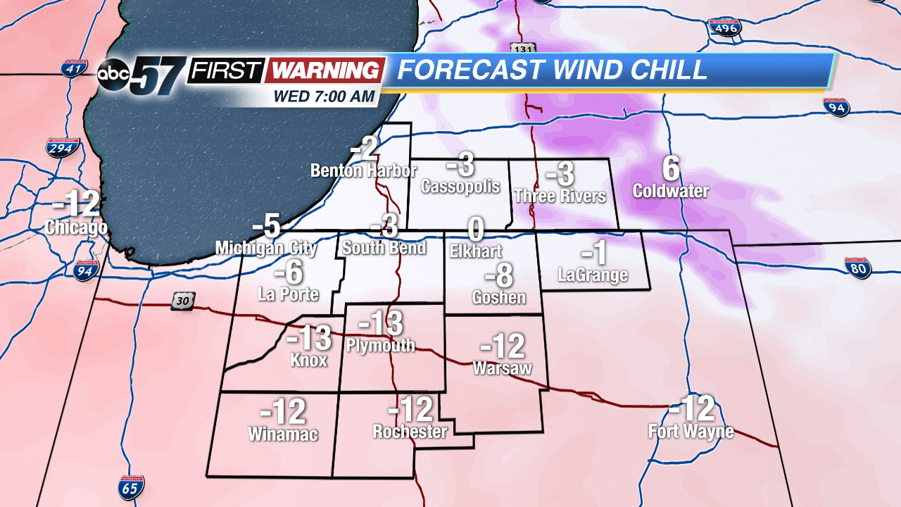
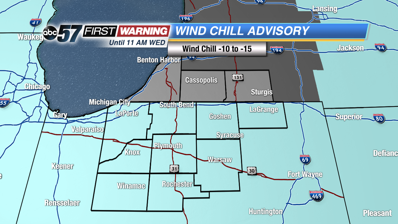
Lows will be next zero Tuesday and Wednesday night with a wind chill of -10 to -15 for most of Michiana. Dress warm and limit outdoor exposure, take extreme cold precautions.
Frigid forecast for the rest of 2017 and start of 2018. High temperatures won’t break 20 for at least the next week, some days struggling to break into the double digits. Lows will be in the single digits and at times near zero, with the wind chill even colder. Light snow and flurries will also be in the forecast, mostly lake effect that will only bring up to an inch or two each day from the state line north.
Tonight: Partly cloudy, flurries, low of 2.
Wednesday: Partly cloudy, flurries, high of 10.
Thursday: Partly cloudy, chance of snow late, high of 15.
Friday: Light snow showers, highs in the mid-teens.