
-
1:06

Marshall County Humane Society reschedules Dog Egg Hunt
-
2:01

Martin Luther King Dream Center hosts MLK March in South Bend
-
1:54

South Bend Cubs opener postponed by weather, but fans still find...
-
2:01

Sights and sounds from South Bend Cubs Opening Day
-
1:32

NIPSCO ’flatly rejected’ further negotiations, USW workers...
-
3:36

The art of groundskeeping at Four Winds Field
-
3:32

The history behind America’s only ballpark synagogue turned...
-
1:59

South Bend opens season against Quad Cities in familiar Midwest...
-
4:21

South Bend Cubs owner discusses $48M stadium expansion, changes...
-
3:19

A look into the new South Bend Cubs 2026 roster
-
5:17

Expansion goes beyond Four Winds Field, new restaurants, bars,...
-
6:18

What’s new this season? South Bend Cubs unveil major improvements...

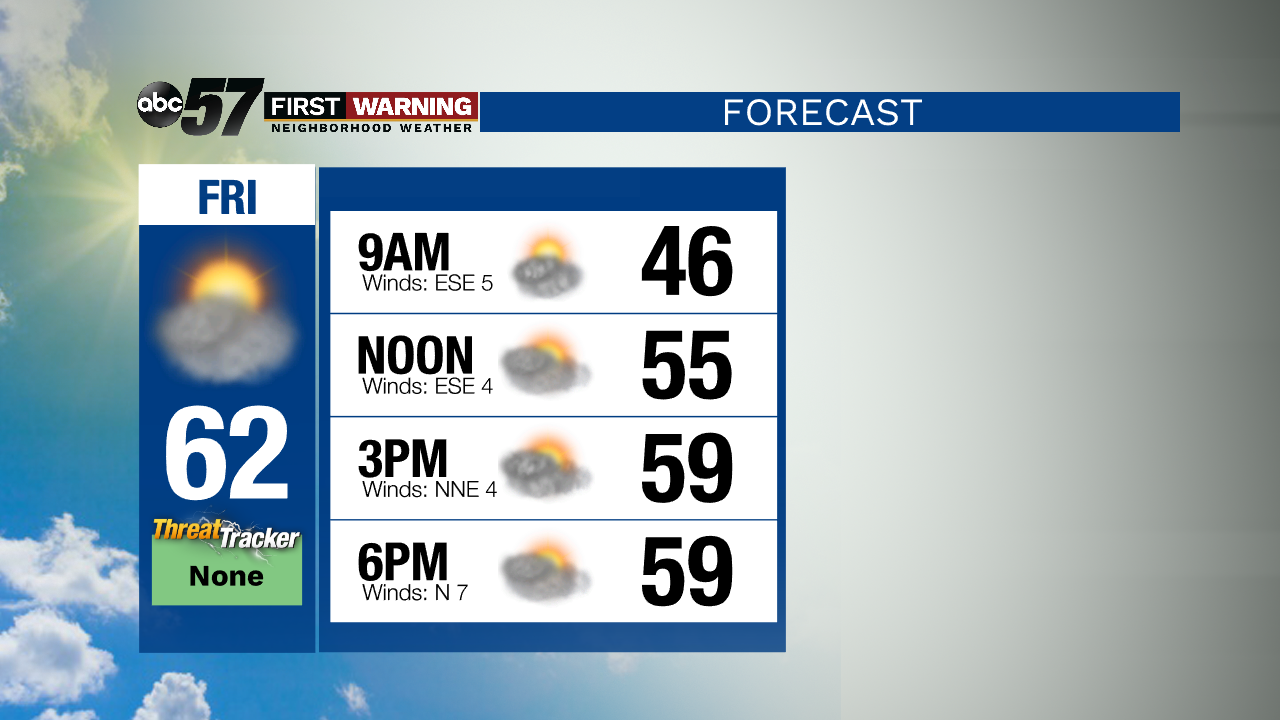
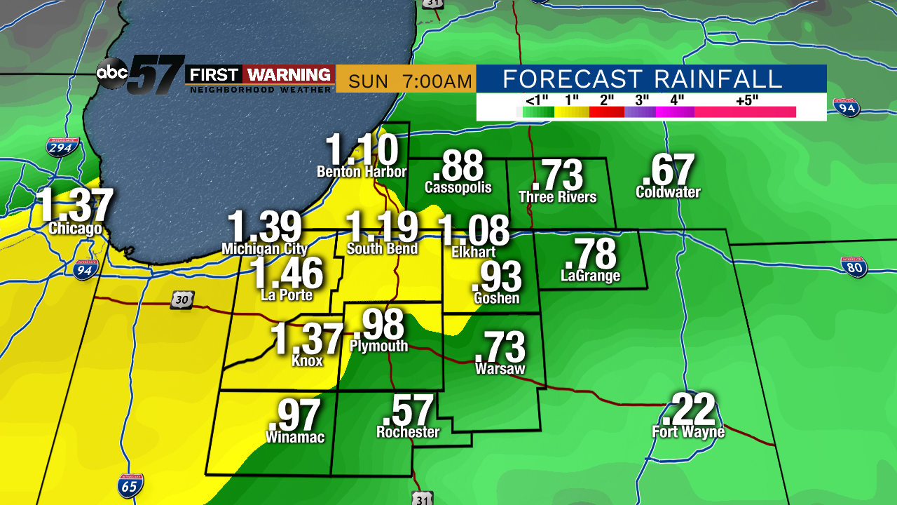
Clouds break and temperatures trend a little warmer Friday before widespread rain, Saturday. Saturday could be a soaker with more than an inch of rain possible. Clouds clear again Sunday, fair but cooler with highs near 50. Temperatures rebound quickly, sunny and 60s by Monday. The middle of next week calls for more widespread rain and possible thunderstorms Tuesday into Wednesday.
Tonight: Mostly cloudy. Low of 42.
Friday: Mostly cloudy. High of 60.
Saturday: Rain likely. High of 54.
Sunday: Mostly sunny. High of 52.
Sign up for the ABC 57 Newsletter