


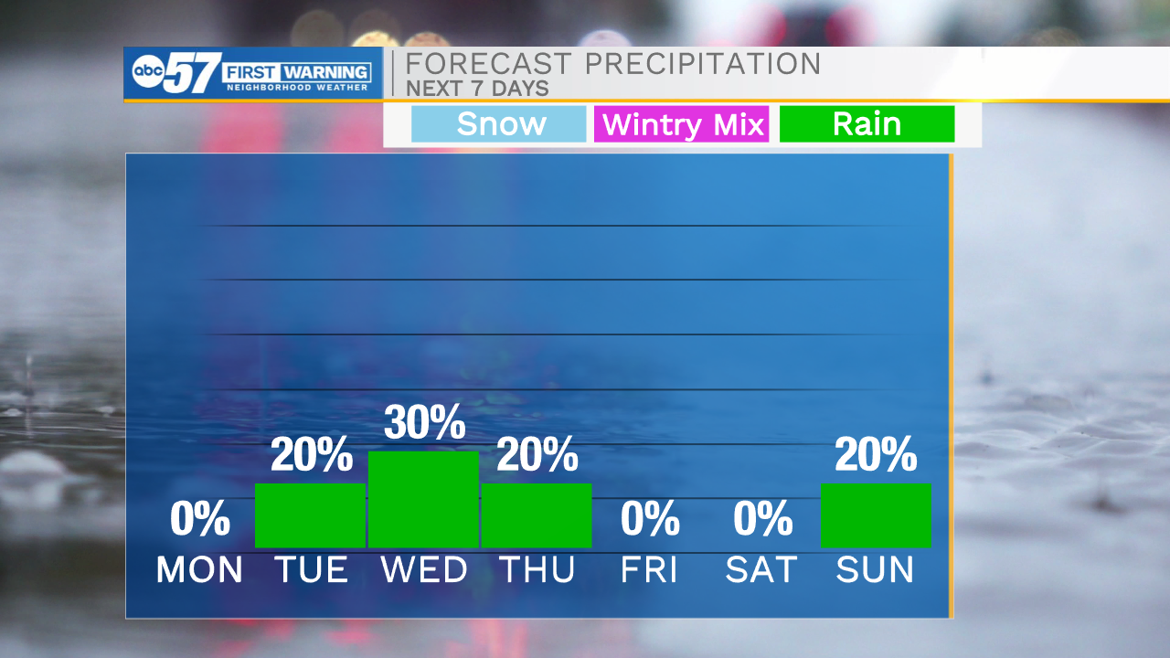
This morning temperatures are very warm with most places seeing lows in the upper 60s. As we head into the afternoon the heat will continue to build via sunshine and breezy winds with gusts ranging 20-25mph. This will help to boost highs into the upper 80s to potentially lower 90s today. We will add to that heat tomorrow with widespread 90s in the forecast. It will become more humid as well, so make sure to drink plenty of water and take frequent breaks if you are working outdoors. Rain and storm chances return to the forecast tomorrow. There is a low chance for a stray afternoon shower/storm or two, but overall we will have to wait until tomorrow night for a line of showers and storms to roll through. Showers will linger through Wednesday morning. Low rain chances will hold in the forecast for Wednesday afternoon and Thursday morning, then its dry weather into the beginning of the weekend. Another round of showers and storms look to arrive Saturday night into Sunday. Highs this weekend will begin to drop into the 70s on Wednesday, and hold there through the weekend.
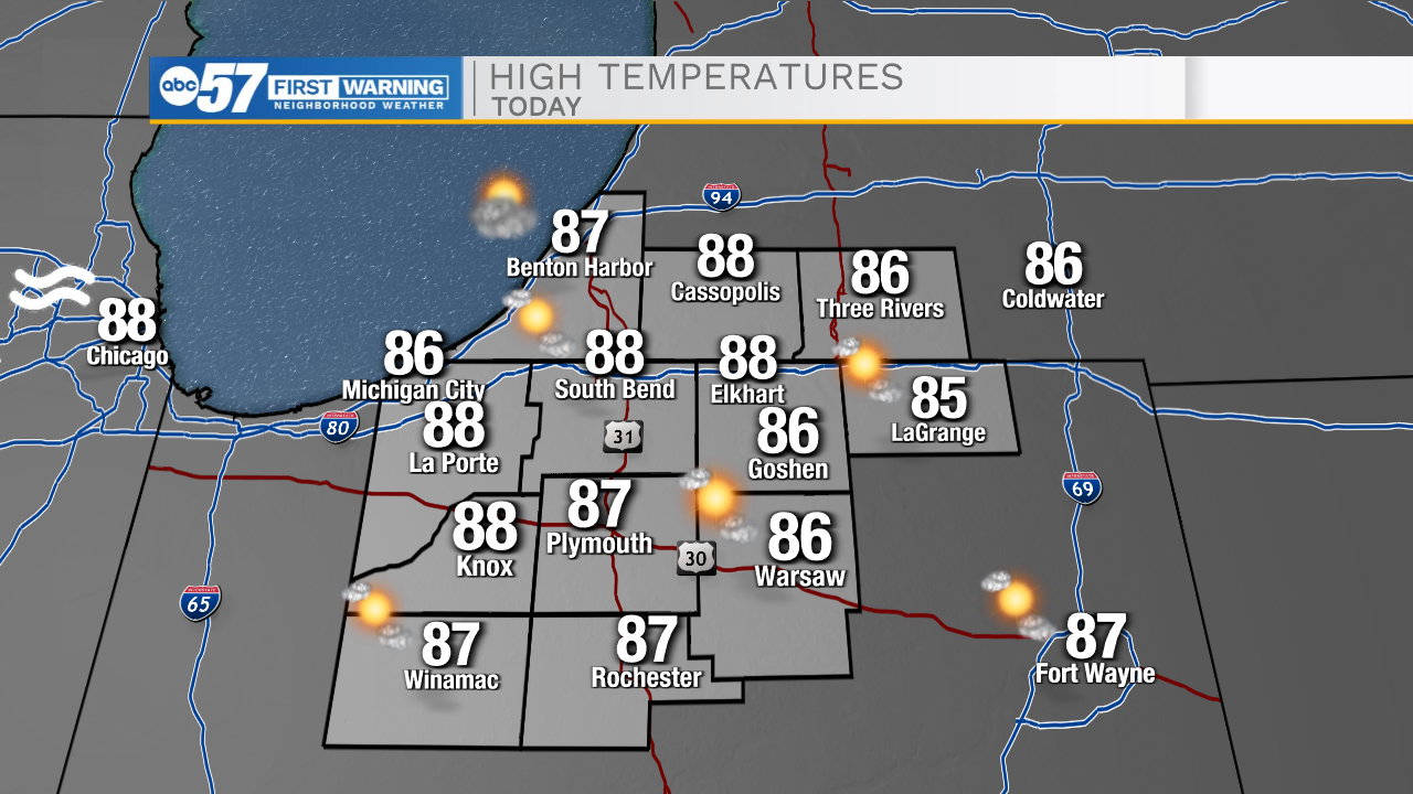
Today: Mostly sunny. High 88.
Tonight: Partly cloudy. Low 70.
Tomorrow: Mostly sunny. High 90.
Wednesday: AM showers. High 72.