Morning thunderstorms then cooler and less humid
By: Emily Kennedy
Posted: Jul 8, 2021 2:41 AM EDT

-
3:03

Looking to younger generations to keep Dyngus Day thriving
-
3:06

Even as rivers recede, Marshall County still dealing with flooding
-
3:29

Michigan fans gather in Indianapolis ahead of National Championship...
-
3:22

Hamlet local and tow truck driver describes US 30 crash site...
-
4:28

Dyngus Day celebrations highlight voter turnout, transparency
-
4:54

Now-disbanded St. Joseph County Metro Homicide Unit investigator...
-
0:52

Shots fired on Sunnymede Avenue Saturday, cars and homes struck
-
1:18

Clouds returning and drizzle possible in the afternoon
-
0:57

The cold front passed us, the rain is done for now, and the chill...
-
0:31

Crash following police chase shuts down intersection in downtown...
-
1:07

Easter Bunny stops at Tako Loco and Tokyo for Easter fun
-
0:49

Annual Easter Egg Hunt brings families together in Elkhart

ABC57 First Warning Neighborhood Weather Forecast
Thursday, July 8th, 2021
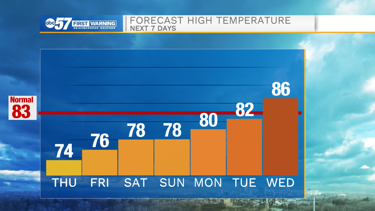
Scattered thunderstorms move through this morning as a cold front slides across Michiana. This will drop the humidity and heat. We'll top out in the mid-70s with breaks in the clouds later today. Another nice day on Friday before the chance of rain increases heading into the weekend. While it doesn't look like a washout, scattered showers and storms are expected Saturday through Monday.
Today: Morning thunderstorms. High 74.
Tonight: Mostly to partly cloudy. Low 59.
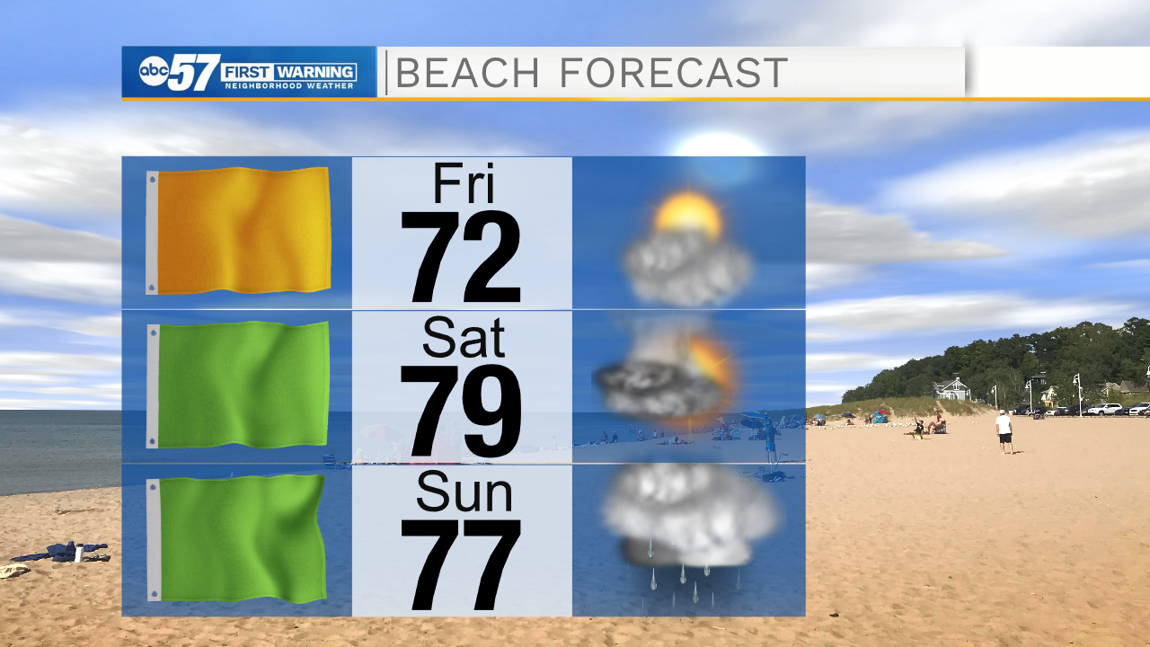
Friday: Partly cloudy. High 76.
Saturday: Scattered storms. High 78.
Sign up for the ABC 57 Newsletter