Possible record breaking high temperatures again Monday
By: John Hammersmith
Posted: Nov 8, 2020 4:30 PM EDT

-
1:06

Marshall County Humane Society reschedules Dog Egg Hunt
-
2:01

Martin Luther King Dream Center hosts MLK March in South Bend
-
1:54

South Bend Cubs opener postponed by weather, but fans still find...
-
2:01

Sights and sounds from South Bend Cubs Opening Day
-
1:32

NIPSCO ’flatly rejected’ further negotiations, USW workers...
-
3:36

The art of groundskeeping at Four Winds Field
-
3:32

The history behind America’s only ballpark synagogue turned...
-
1:59

South Bend opens season against Quad Cities in familiar Midwest...
-
4:21

South Bend Cubs owner discusses $48M stadium expansion, changes...
-
3:19

A look into the new South Bend Cubs 2026 roster
-
5:17

Expansion goes beyond Four Winds Field, new restaurants, bars,...
-
6:18

What’s new this season? South Bend Cubs unveil major improvements...

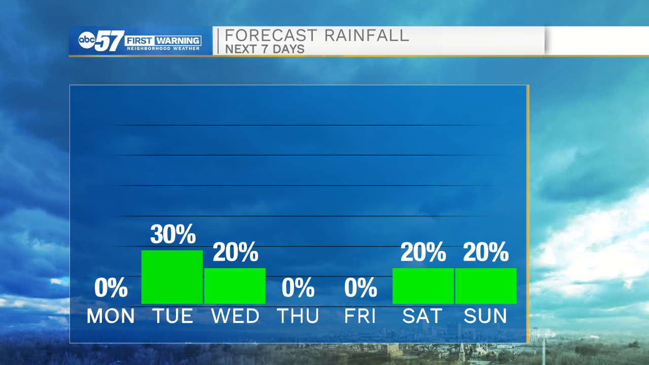
Clear skies will remain in the forecast through tomorrow evening, and then cloud cover will increase into Tuesday. A few stray showers are possible by early Tuesday afternoon with increasing rain chances into Tuesday evening. Rain showers will clear out by the early to mid-morning hours Wednesday. Wednesday afternoon temperatures will only top out in the lower 50s under sunny skies. Colder, more seasonable temperatures stick around through the ending part of the week and next weekend. More rain chances return to the forecast next Saturday and Sunday.
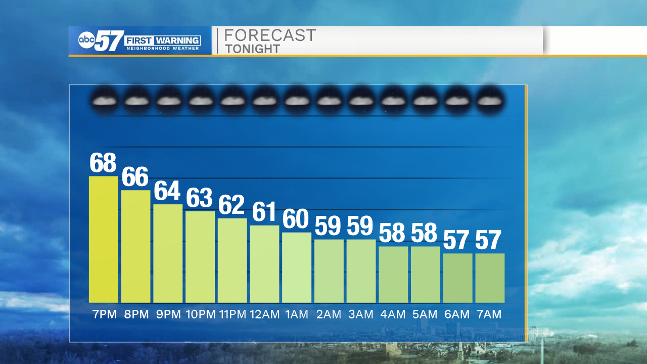
Tonight: Clear. Low 57.
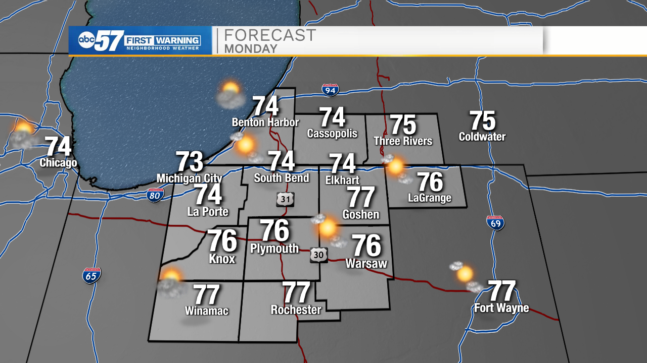
Tomorrow: Mostly sunny. High 74.
Tuesday: Rain showers. High 72.
Wednesday: Sunny. High 50.
Sign up for the ABC 57 Newsletter