Rain and storm chances increase later this week

-
4:27

Notre Dame prepares to welcome 80,000 fans for Luke Combs concert...
-
2:25

Elkhart County Fairgrounds announces expansion project to begin...
-
2:12

Sawyer businesses and residents react to closing of Greenbush...
-
1:07

Tonight is the deadline to fill out the FAFSA in Indiana
-
2:49

IRS spokesperson talks deadline, extensions, scams
-
2:12

Potential severe weather entering Michiana soon
-
2:20

Facebook group leads Ohio woman to lost family ring
-
4:02

Library looking for community support for outdoor garden space
-
1:58

Cloudy for a bit, storms return later
-
1:52

Flood risk this morning behind strong storms
-
2:17

South Bend Cubs beat Beloit in home opener at Four Winds Field
-
2:25

Radio Sabor Latino returns home after 26 years

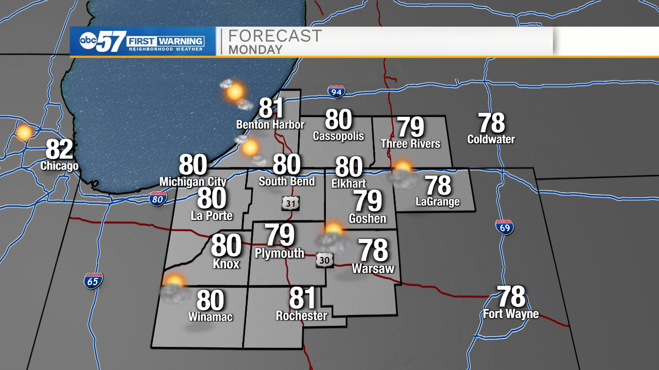
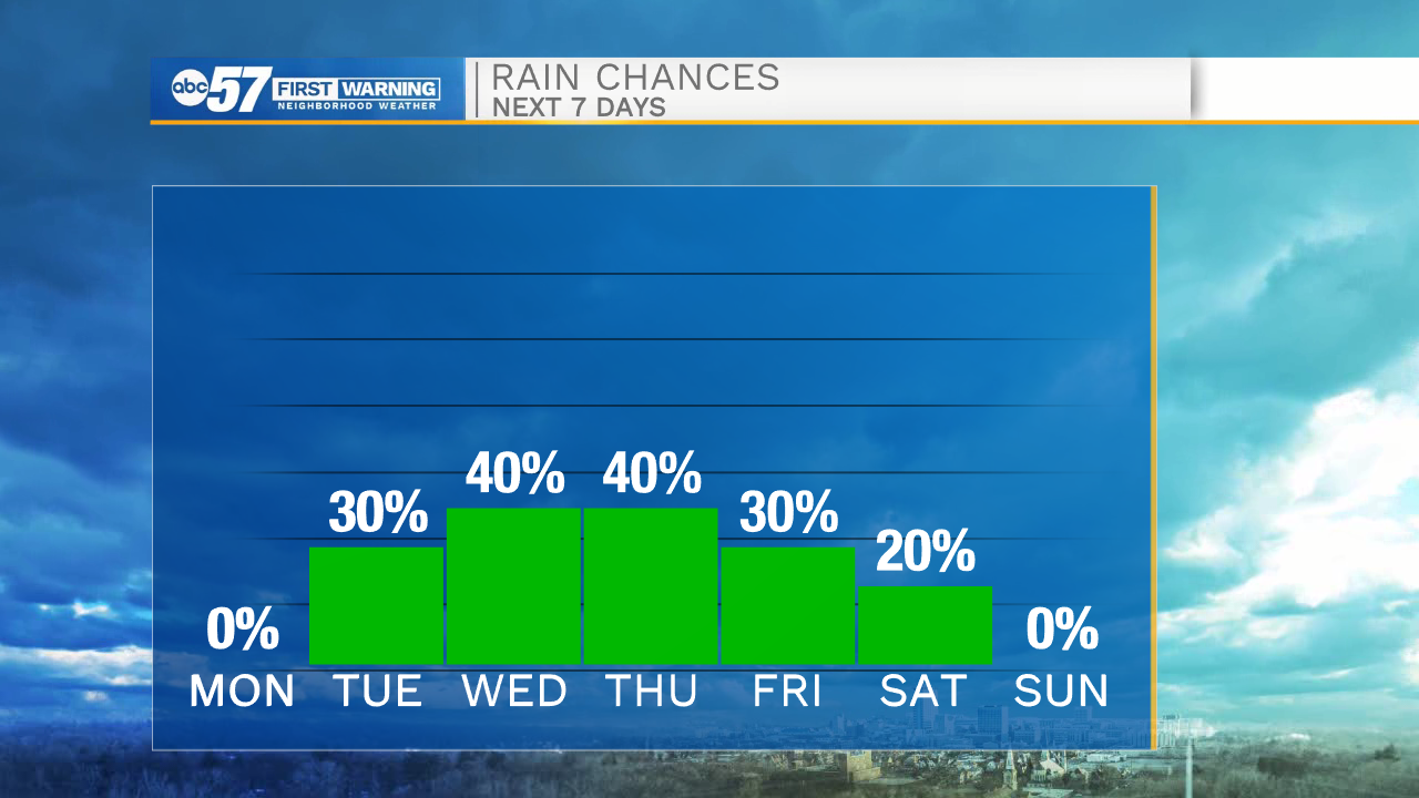
It will be another quiet evening for us here in Michiana. Temperatures will drop into the mid 50s again tomorrow morning making it a chilly start to the week. More sunshine and lower humidity is expected tomorrow afternoon with high temperatures in the lower 80s. Moisture increases Tuesday allowing humidity to rise and isolated storm chances to increase. Rain and storm chances will turn scattered into Wednesday afternoon. Moisture will continue to linger into the ending part of the week, keeping the storm chances steady for Thursday and Friday. A cold front will move in Saturday, giving us a small break from the rain next weekend.
Tonight: Mostly clear. Low 56.
Tomorrow: Mostly sunny. High 80.
Tuesday: Isolated storms. High 82.
Wednesday: Scattered showers/storms. High 84.