
-
2:24

South Bend Clinic to offer free full body skin cancer screening...
-
0:42

Pleasant today, storms tomorrow
-
2:51

High school prom party ends with gunfire, one dead, two injured
-
0:44

Viral clunker makes reappearance Sunday for charity event
-
1:40

Potawatomi Zoo hosts Mother’s Day Crafting with Creatures
-
0:49

Sunny, but cool for Mother’s Day
-
0:50

Chilly out the door
-
1:11

One injured in Sunday morning South Bend shooting
-
1:53

Grand Floral Parade celebrates 120 years at Blossomtime Festival...
-
2:51

Postal carriers lead annual Stamp Out Hunger food drive across...
-
1:08

Dogapalooza celebrates four-legged friends and supports Humane...
-
1:15

70s today, cooling tomorrow

Very muggy overnight, the chance of showers and storms building into Tuesday morning.
Shower and storms are likely to start Tuesday, temperatures begin in the low 70s and rise to the upper 70s. Shower taper off towards the late afternoon and evening. There’s a big change over the next ten days towards milder and drier weather. Sunshine and 70s will be the name of the game over the next two weeks.
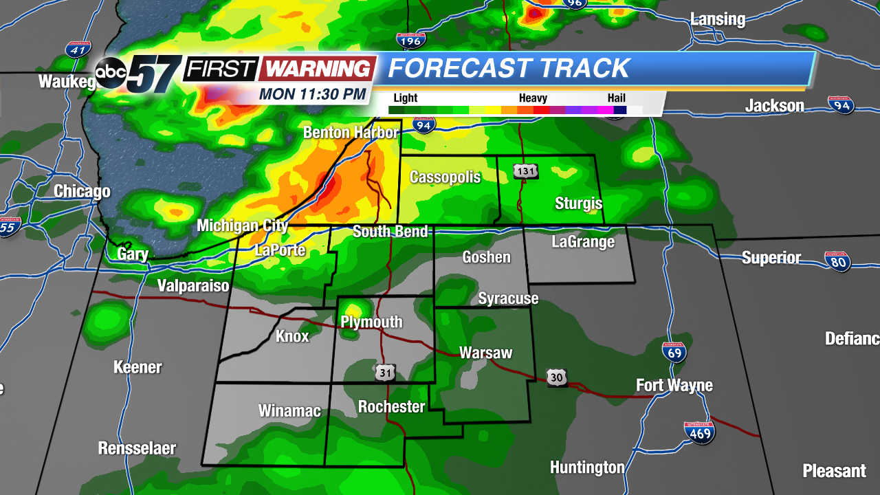 First round of rain may hit before midnight
Tonight: Mostly cloudy, few showers and storms possible, low 72.
Tuesday: Scattered showers and storms, high 78.
Wednesday: Mostly sunny, high of 75
Thursday: Mostly sunny, highs in the low 70s.
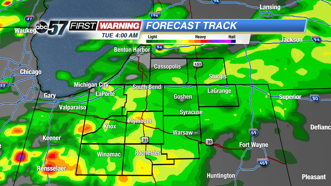 Rain likely by Tuesday morning
Sign up for the ABC 57 Newsletter