Showers and storms will linger into Monday
![](/images/abclogo_gray.png?x)
-
2:30
Mishawaka ‘Designated Outdoor Refreshment Area’ along riverwalk...
-
0:50
Saint Mary’s College breaks ground on Heritage and Research...
-
6:13
Rep. Rudy Yakym discusses Netanyahu’s address to Congress and...
-
3:41
Three civil rights lawsuits filed against Elkhart Police
-
1:03
The humidity returns, Sunday
-
1:57
Why the dew point is the best way to represent humidity
-
4:18
What is Project 2025 and why does it matter?
-
0:45
The South Bend Police Department hosts inaugural community track...
-
1:10
’A Rosie Place’ in South Bend welcomes new equine friend
-
1:42
Thanks to the weather, Michiana corn seeing rapid growth
-
4:10
Developing Downtowns: South Bend
-
2:25
After closure in 2020, YMCA reopens in downtown
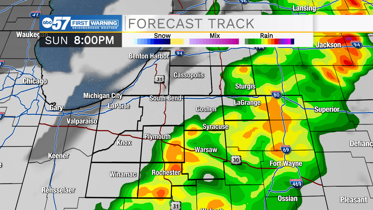
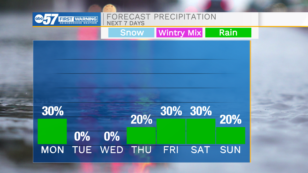
Showers and storms look to impact Michiana through the evening and overnight hours. A few storms could be on the strong to severe side, mainly before 10pm. After 10pm, most of the storm activity will move out, but isolated showers will stick around. Tomorrow morning looks mostly quiet until we get closer to lunchtime. Another round of scattered showers will impact portions of Michiana before clearing out into the early afternoon. Highs tomorrow will only top out in the upper 50s. Temperatures will keep falling into the middle of the work week with highs Tuesday and Wednesday in the 40s. Our next chance for a few isolated showers will arrive Thursday, then scattered chances into Friday and Saturday. High temperatures next weekend will warm back into the lower 60s.
![](https://newscdn2.weigelbroadcasting.com/1KIPp-1650833064-embed-HRRR%20Ext%20FORECAST%20TRACK.png)
![](https://newscdn2.weigelbroadcasting.com/MXHRt-1650833071-embed-Tonight%20-%20Tomorrow.png)
![](https://newscdn2.weigelbroadcasting.com/J9F5C-1650833079-embed-7-Day%20Precip%20Type%20Planner%20PM.png)
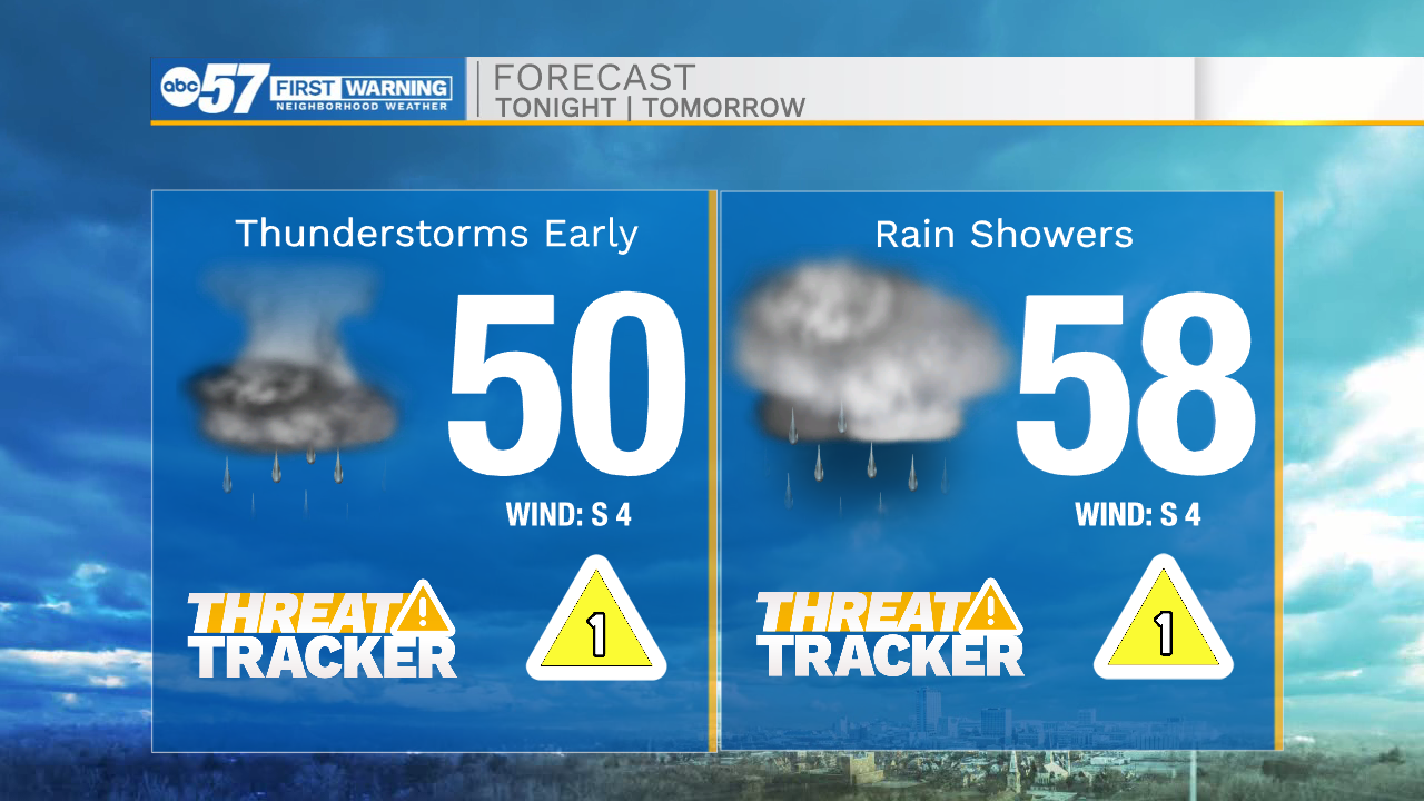
Tonight: Scattered showers/storms. Low 50.
Tomorrow: AM rain. High 58.
Tuesday: Mostly sunny. High 48.
Wednesday: Mostly sunny. High 48.