Snowy pattern begins with lake effect Thursday
By:
Tom Coomes
Posted: Dec 6, 2017 4:21 PM EDT | Updated: Dec 6, 2017 5:22 PM EDT

-
3:03

Looking to younger generations to keep Dyngus Day thriving
-
3:06

Even as rivers recede, Marshall County still dealing with flooding
-
3:29

Michigan fans gather in Indianapolis ahead of National Championship...
-
3:22

Hamlet local and tow truck driver describes US 30 crash site...
-
4:28

Dyngus Day celebrations highlight voter turnout, transparency
-
4:54

Now-disbanded St. Joseph County Metro Homicide Unit investigator...
-
0:52

Shots fired on Sunnymede Avenue Saturday, cars and homes struck
-
1:18

Clouds returning and drizzle possible in the afternoon
-
0:57

The cold front passed us, the rain is done for now, and the chill...
-
0:31

Crash following police chase shuts down intersection in downtown...
-
1:07

Easter Bunny stops at Tako Loco and Tokyo for Easter fun
-
0:49

Annual Easter Egg Hunt brings families together in Elkhart

Lake effect snow showers begin early Thursday morning and last through midday. Final totals of one to three inches are likely in the lake effect zone from South Bend – Elkhart and northward. The amount of snow may not be overwhelming but most of it falls during the morning commute. Snow ends Thursday afternoon, sunshine returns Friday before more widespread snow Saturday.
Tonight: Mostly cloudy, breezy, snow after 3 AM, low 24.
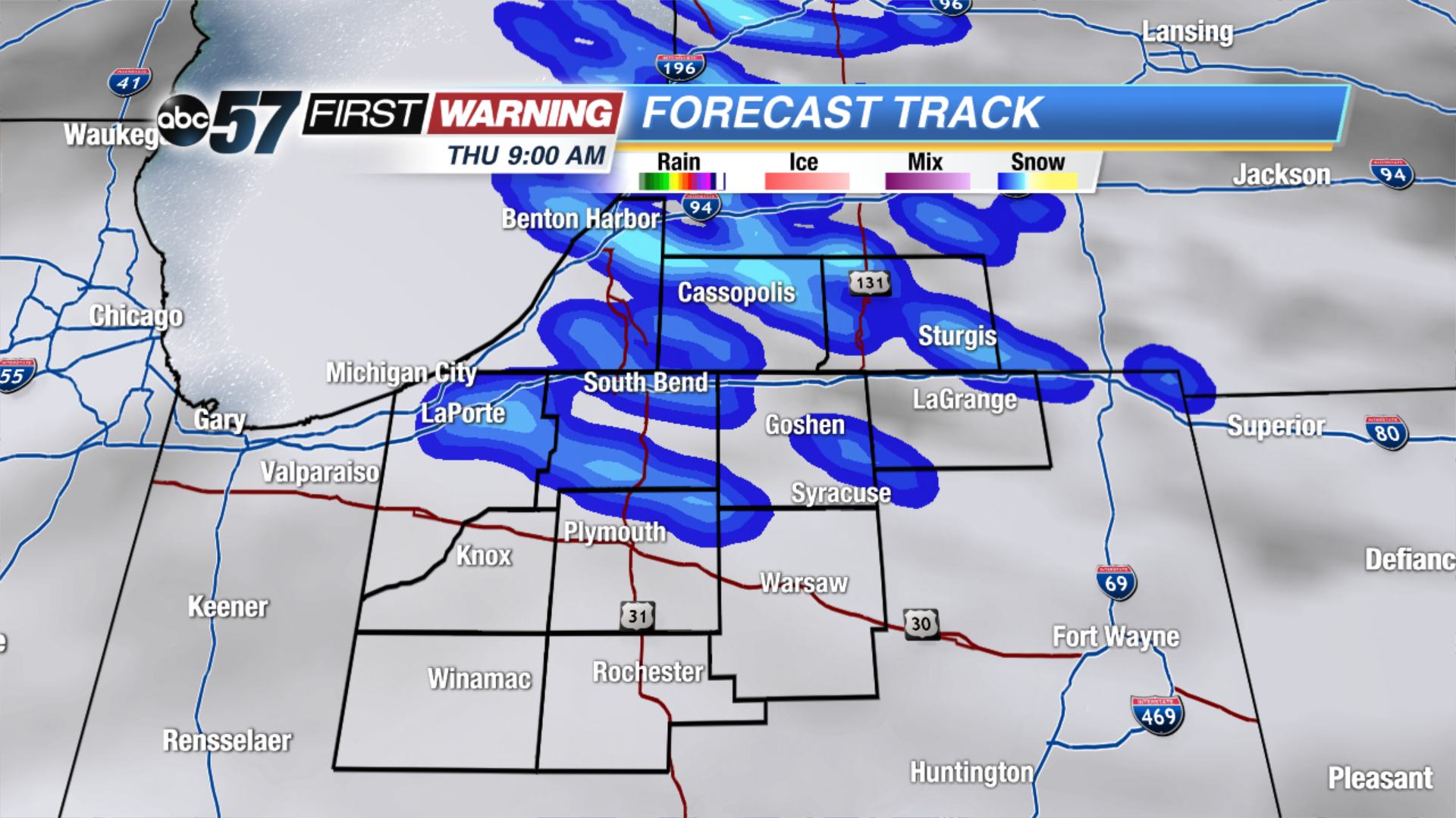 Lake effect snow lasts through Thursday morning
Thursday: Lake effect snow showers, high of 28.
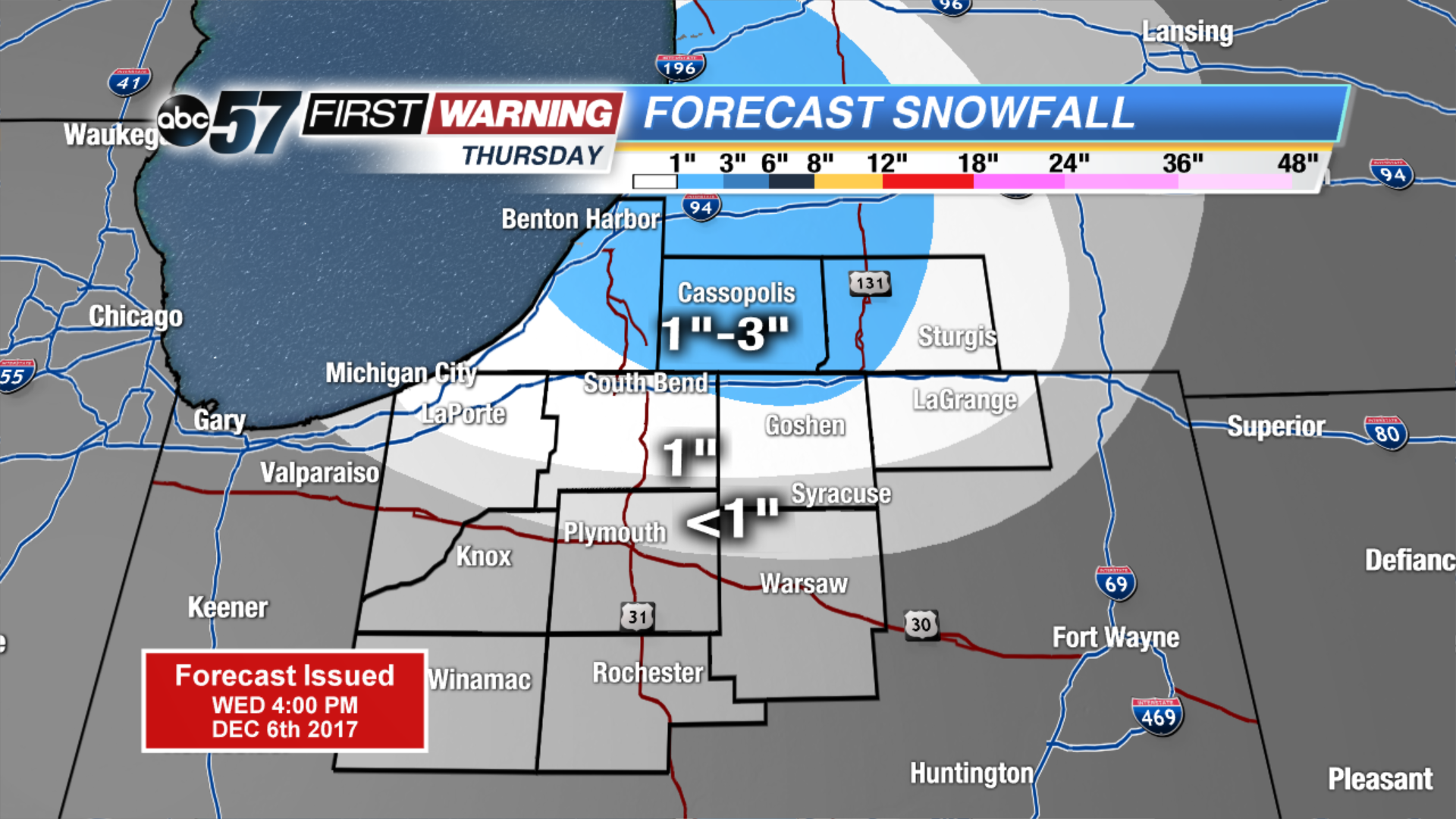 Up to 1
Up to 1
Up to 1
Friday: Mostly sunny, high of 30.
Saturday: Snow showers, highs near 30.
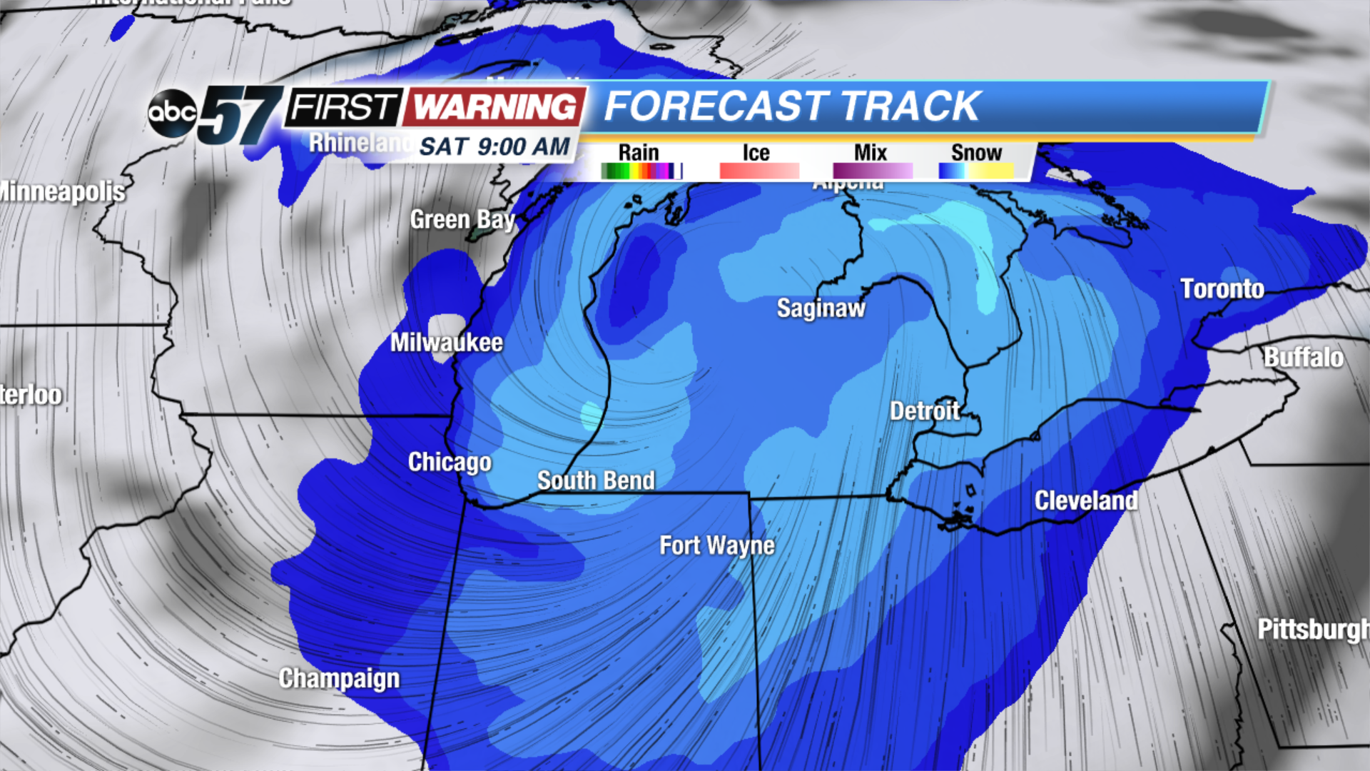 More widespread snow expected Saturday morning
Sign up for the ABC 57 Newsletter