


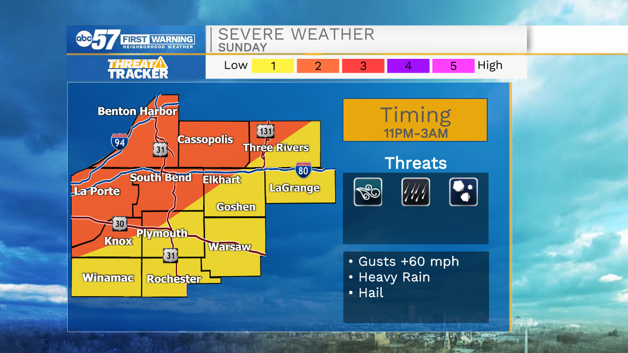
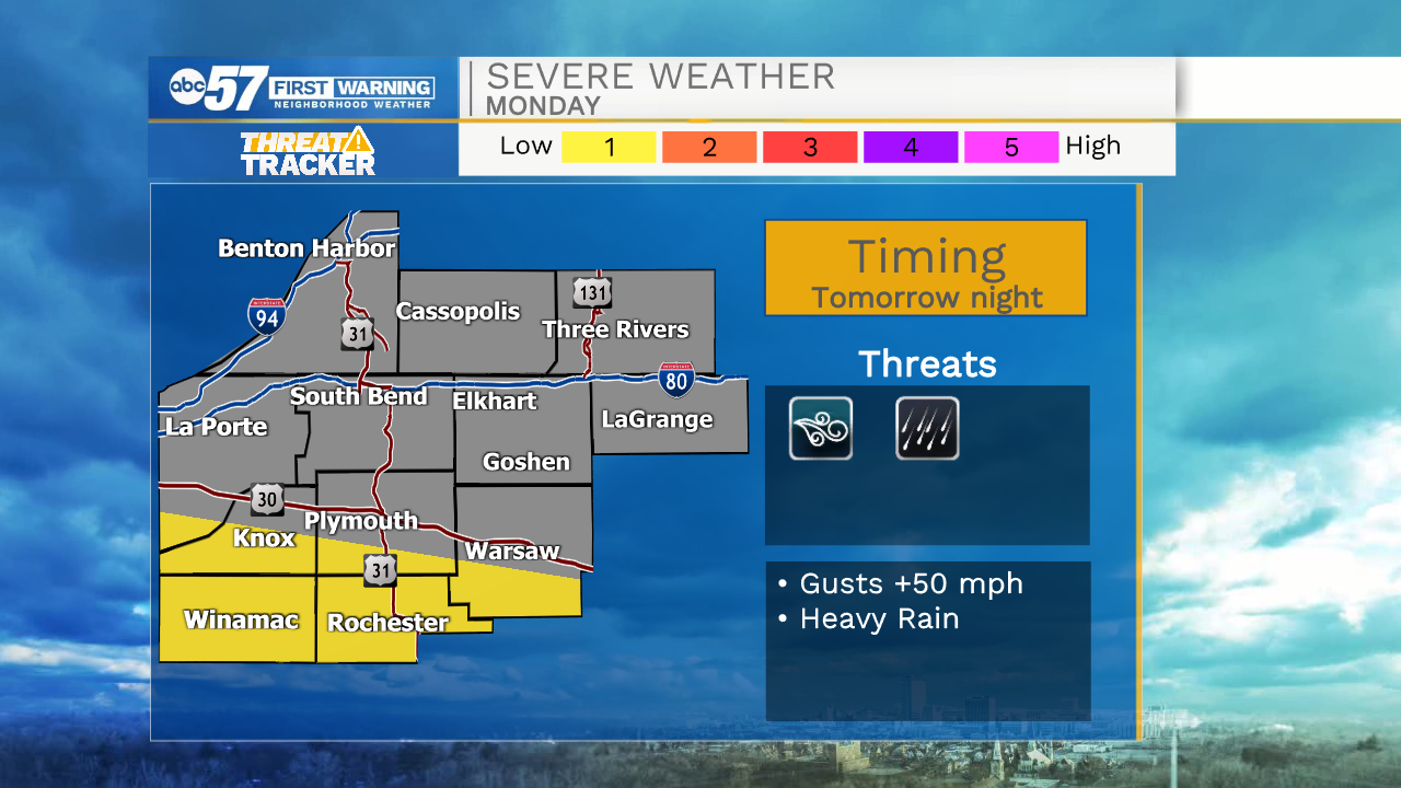
Isolated light rain showers are possible this evening primarily in northwestern Michiana. Better chances for showers and storms will arrive around midnight. A few of those storms could be on the strong to severe side with the primary threat of strong winds up to 60mph. There is also a lower threat of hail possible as well. Showers and storms will begin to clear out tomorrow morning, but isolated rain chances remain in the forecast throughout Monday afternoon and evening. Tomorrow night there is another chance that a few storms could be on the stronger side in southern Michiana. Red Flag warnings remain in effect for Lake Michigan throughout Monday.
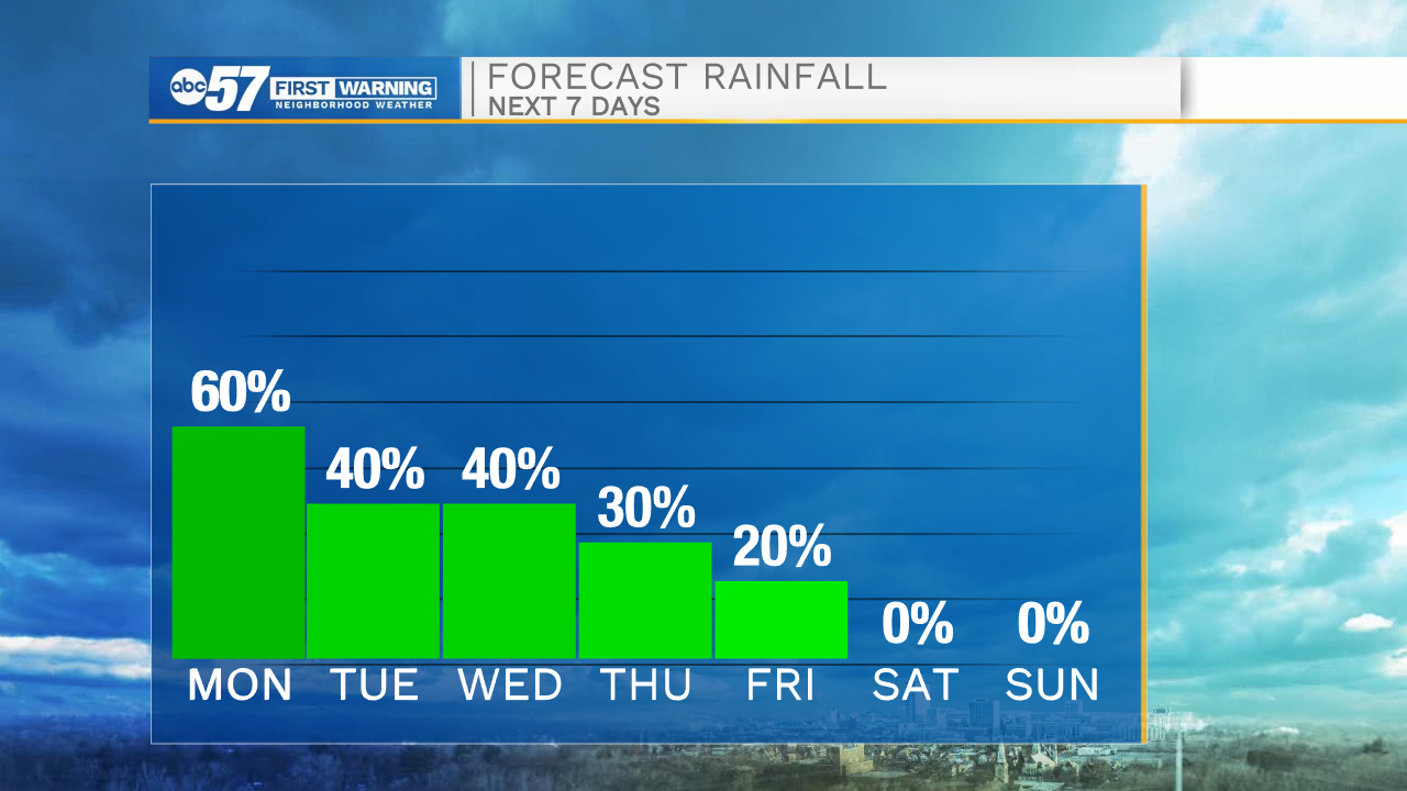
The rest of the week, off and on rain showers and thunderstorms are possible for portions of Michiana. We will finally begin to see rain chances clear out as we head into next weekend. Temperatures this week will stay in the mid 70s, but then later drop into the lower 70s next weekend.
Tonight: Scattered thunderstorms. Low 66.
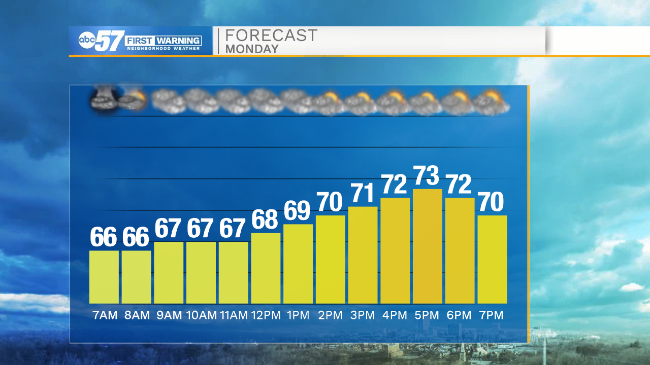
Tomorrow: Isolated showers and storms. High 73.
Tuesday: Mostly cloudy with isolated showers. High 75.
Wednesday: Mostly cloudy with isolated showers. High 78.