Cold front arrives before midnight Friday, showers and storms follow
By:
Tom Coomes
Posted: May 20, 2022 8:04 PM EDT

-
3:22

Calm today, storms return Sunday
-
2:58

Thousands of people across Michiana experienced power outages...
-
1:13

Earl Wigfall holds Detective Trivia Night for Sheriff campaign
-
1:50

Preparations underway for South Bend’s annual St. Patrick’s...
-
0:24

CAVA set to open in Mishawaka
-
1:16

Groundbreaking project underway for housing development
-
0:52

Jefferson Boulevard renamed to kickoff St. Patrick’s Day festivities
-
0:35

Congressman Rudy Yakym on Iran conflict
-
3:22

A look at some of the big concerts coming to St. Joseph County...
-
1:50

Mild Sunday, snow Monday
-
4:37

Morris Performing Arts Center show season starts tonight
-
1:53

Thousands without power due to high wind gusts

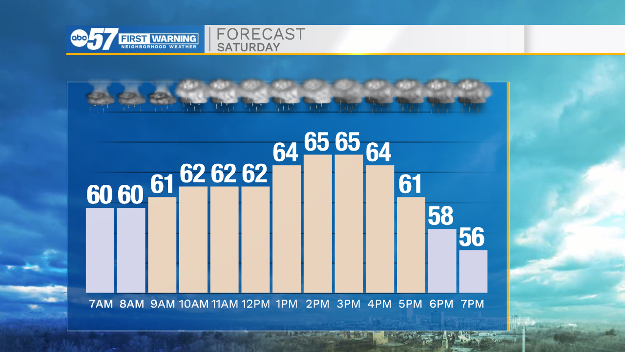
The cold front moves through Michiana early Saturday, bringing with it showers and thunderstorms. The front likely stalls between Plymouth and Ft. Wayne Saturday, keeping the area under rounds of rain, but the storm threat is to the southeast. Severe weather is unlikely. Temperatures will be cool to mild through most of next week.

Tonight: Rain and thunderstorms. Low 60.
Saturday: Rounds of rain. High 66.
Sunday: Mostly cloudy and cooler. High 60
Monday: Mostly sunny. High 66
Sign up for the ABC 57 Newsletter