


ABC57 First Warning Neighborhood Weather
Friday, June 26th, 2020
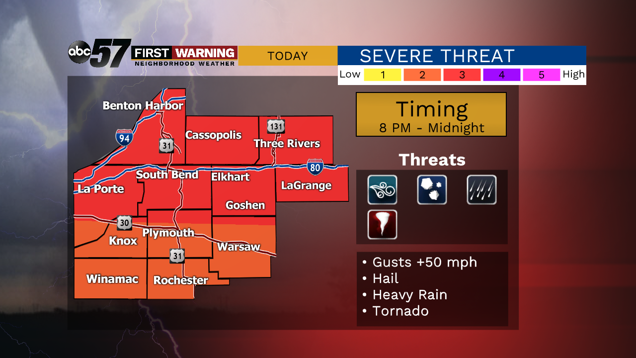
We're watching the RADAR very closely Friday evening for possible severe weather across Michiana tonight. A line of strong thunderstorms will move across our area between 7 PM and midnight, bringing with it strong wind gusts, heavy rain and some small hail. A brief tornado is also possible, but not likely. Temperatures will fall through the 80s and 70s into the upper 60s by Saturday morning.
A few more scattered showers and thunderstorms are possible on Saturday, but no widespread severe weather is expected. Highs will finish in the lower 80s. We should be mostly dry on Sunday with temperatures closer to 90 degrees. A stray storm is possible on Sunday as well. Better storm chances arrive by Monday afternoon with very warm temperatures sticking around. We'll end the month of June and begin the month of July on a hot, humid and dry note.
Tonight: Scattered storms. Some could be severe with damaging winds and heavy rain. Low 68.
Saturday: Scattered showers and a few thunderstorms. High 83.
Sunday: Partly cloudy with a stray storm possible. High 87.
Monday: Isolated thunderstorms during the afternoon. High 88.